

A One Week Off Road Oman Itinerary: Adventures in Wadi Bani Awf and Beyond
Scribbled by Claire ◊ 19 Mar 2025
Do you want to visit Oman, but want to get away from the crowds and into the mountains? Read on for a totally unique, itemised, off road Oman adventure through the famous Wadi Bani Awf and Hajar Mountains, including camping locations, optional stops, road descriptions and much more, to help you plan your itinerary!
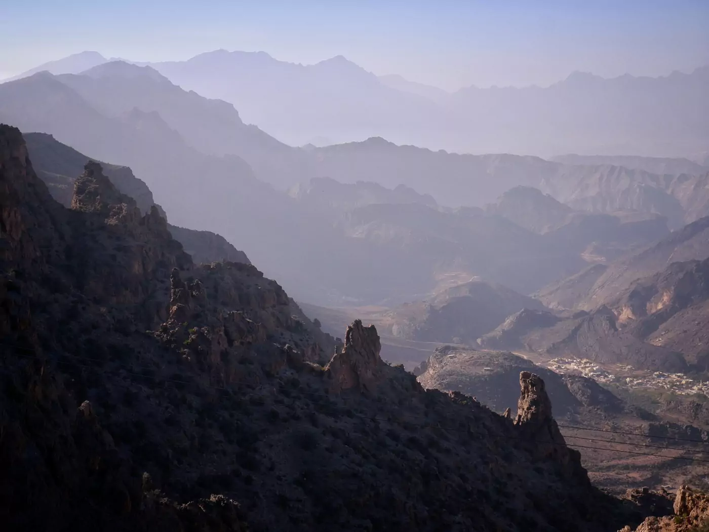
Are you looking for an unconventional, exhilarating off road Oman trip? Craving some lesser-visited sites that prioritise spectacular scenery and alfresco adventures? Well, this detailed off road Oman itinerary is the one we wished we had before our first trip! Planning a logical, time-effective route through the mountains turned out to be a tricky affair.
You may ask – why should I spend entire week in Wadi Bani Awf and the surrounding Hajar Mountains? Well, we spent two months camping across different regions of the country and this was, by far, our favourite area. The mountain scenery is jaw-dropping, the roads are challenging but quiet, and the villages are the friendliest we encountered.
The camping was the most spectacular in Oman, and there is so much to do that one week only really scratches the surface. Wadi Bani Awf and the Hajar Mountains are also conveniently located within an hour of Muscat and Nizwa. It’s perfect!
If you have two weeks in Oman, this off road itinerary is perfectly compatible with our classic one-week road trip from Muscat, making a brilliant two-week journey that covers all the highlights of northern Oman.
We recommend checking out our guides to camping in Oman and driving in Oman if you are considering following this itinerary. They cover everything you need to know, including navigation, finding the best campsites, road rules, safety, and more.
IN THIS GUIDE //
Oman Off Road: Wadi Bani Awf Route
THIS OFF ROAD OMAN ITINERARY
DAY 1: MUSCAT TO WADI AL ABYAD
GPS AND NAVIGATION FOR OFF ROAD OMAN TRIPS
DAY 2: WADI AL ABYAD TO WADI AS SAHTAN
DAY 3: WADI AS SAHTAN TO WADI BANI AWF
DAY 4: WADI BANI AWF TO JEBEL SHAMS
DAY 5: JEBEL SHAMS TO WADI DAMM
DAY 6: WADI DAMM POOLS TO NIZWA
DAY 7: NIZWA TO MUSCAT
WHERE TO STAY IN MUSCAT
OFF ROAD OMAN ITINERARY GOOGLE MAP
FINAL THOUGHTS – OMAN OFF ROAD
This post may contain affiliate links. If you book through these links we may make a small commission at zero cost to you. It helps us pay for the upkeep of this blog. Thank you!
About this Oman Off Road Itinerary
This seven-day off road itinerary requires a four-wheel drive (4WD or 4×4) vehicle and a little bit of general driving confidence. However, none of the routes are difficult and rarely do you need to use four-wheel drive on the roads and tracks.
Roads | the terrain on this route comprises a few narrow trails, cliff edges and drop-offs. It’s subjective, I know, but I’m a nervous passenger and had no trouble with the routes proposed on this itinerary. We’ll mention if any road requires extra care.
Camping | this itinerary also assumes you will be wild camping. Camping in Oman is, by far, the easiest (and cheapest) way to travel around this region. However, it is possible to do most of this route as day trips from either Nizwa or Muscat, if you are happy driving the extra distances (we’ve recommended places to stay, too).
Time | this 4WD route is broken down into detailed steps, spread over seven-days, with optional extras mentioned where applicable. You could rush through it a little quicker, or spend far more time meandering in the mountains.
Below is a map combining both of our one-week Oman itineraries, with Wadi Bani Awf and the Hajar Mountains denoted by the blue route. The classic, paved road trip from Muscat is the red route.

Day 1 – Wakan Village
〈 Route: Muscat → Nakhal Fort → Wakan Village → Wadi Al Abyad 〉
For day one of this itinerary, head out west from Muscat on the Muscat Expressway, then head south on the 13. Turn off the 13 towards Ghubrah, which leads to one of the most beautiful regions of the Hajar Mountains.
There’s more information on where to stay and things to do in Muscat at the bottom of this post.
86 kilometres
Nakhal Fort
Along Route 13 is the little town of Nakhal. This unassuming little town houses the most beautiful fort in Oman (in our opinion!). Pop by Nakhal Fort (entry fee 0.5 OMR) on route to Wakan Village, it doesn’t take long and even from the outside looks pretty epic.
50 kilometres
Wakan Village
The highlight of this day is Wakan Village, a surprisingly popular stop for tourists (it even has parking attendants to help when busy!). This small mountain village, about 2000 metres above sea level, boasts outstanding views of the neighbouring peaks, terraced gardens and date palms surrounding it.
There is a popular hike behind the village which starts by following the ancient falaj irrigations systems. Walk to at least 23.139617, 57.729594 for the best views and a shady place to rest before returning.
Access | the village is up a reasonably steep, winding dirt track. It is not difficult to drive but watch for oncoming cars because sometimes the road is a little narrow for passing. At the bottom of the mountain there are men who will drive you up for a fee if you do not have a four-wheel drive vehicle. Parking in Wakan Village is outside the Wakan Tourist Information Centre which can be found on Google Maps.
Wakan Village has a small café with panoramic views and a stall with a cute honesty box for coffee and baked goods. There is also the Sama Wakan Heritage Home if you want to stay overnight.
Remember, although the village is beautiful and has relatively high number of tourists (for Oman), it is still just a normal village. Dress conservatively.
39 kilometres
Wadi Al Abyad
This little wadi hides a sneaky surprise – bright bluish-white calcite pools! It’s also an opportunity to drive through a few shallow rivers and really go off-road for a bit along a wadi. The camping down here is peaceful too, and is a great place to end your day.
Enter via the small road at 23.364111, 57.670512.
Tip | this wadi is impassable in the middle. You must hike to the other side and cannot take a car across (we tried and got stuck between some rocks in a raging river – kind of embarrassing, kind of funny). The best sulphur pools are in the impassable section in the middle of the wadi which you can hike to from either end.
If you have more time, you can drive around to the northern end of the wadi which begins in the tiny settlement of Ad Abyad. It is quite a long drive around but if you have time, go for it – we thought it was really pretty. Despite not having sulphur pools, it has better river driving, no people, lovely camp spots and beautiful date palms that reflect in the pools.
For more information, check out our post about the curious pools of Wadi Al Abyad.
CAMPING IN WADI AL ABYAD
In the southern end of Wadi Al Abyad, anywhere around 23.421314, 57.673015 is great, very near the short hike to the calcite pools with some trees for shade.
Accessing from the northern side, around 23.444263, 57.655063 is up on a ledge, overlooking the small streams in the wadi (quite a short, steep drive up though). If you don’t want to get your car up the path, there is a smaller platform on the northern end of the ledge that is less tricky to reach.
–


GPS AND NAVIGATION FOR 4WD OFF ROAD OMAN
Google Maps worked *almost* perfectly for all three of our trips to Oman, which totalled around 18,000 kilometres. Combined with Google Maps satellite view, it was great for every route we took. In the detailed itinerary below, we mention anywhere that Google is a little sketchy (this was very rare).
Every location mentioned on this itinerary can be found on Google Maps. We have specified the spellings that work best! In many cases, these locations do not have a name or are in Arabic; in those instances, we have provided GPS coordinates.
It’s also totally possible to use Maps.me or Waze, too, if you prefer.
If you want more general information about how we got around, we’ve written a detailed post specifically about driving in Oman.
–
22 THINGS TO DO IN NIZWA | HOW MUCH DOES AN OMAN ROAD TRIP COST?
Day 2 – As Sahtan
〈 Route: Wadi Al Abyad → Ar Rustaq Fort → Yasib → As Sahtan 〉
After your night camping in Wadi Al Abyad, continue west on Route 13 towards the old capital of Oman, Ar Rustaq, a city known for beekeeping and hot springs.
37 kilometres
Ar Rustaq Fort
Another pretty fort built in the 13th century – currently closed for maintenance but check to see if it has reopened. Entry fee 0.5 OMR, open 9am – 4pm daily apart from Friday when it is open from 8am – 11am.
It’s worth having a look around the outside, even if you don’t go in. It’s super impressive and dominates the skyline.
36 kilometres
Wadi As Sahtan
Passing through the narrow, towering, intimidating entrance to this vast wadi area is just a taster of the scenery to come. This is by far our favourite part of the Hajar Mountains, dotted with improbably high villages, thousands of metres up the side of some of the tallest mountains in Oman.
This means there’s a whole bunch of sensational driving routes here, with loads of villages and viewpoints to choose from. How much time you have (and how fast you drive!) will determine how many of the striking little villages you get to see.
– Road To Yasib –
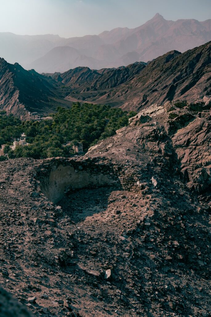
Yasib is a tiny village down an impressively dramatic track cut into the cliffs, right below the summit of Jebel Shams. Apparently, the road climbs up to 1700 metres in under four kilometres! It’s narrow and steep, but not difficult to drive; we didn’t see any other traffic on the entire track. If you decide to take this route, be aware that you’ll have to return the same way you came in and there’s not really much in terms of options for wild camping.
– Madruj and Al Hiwayb –
These are two more of our favourite attractive little villages, sat below the looming peak of Jebel Shams. The views from the roads are outstanding and are genuinely unmatched, in our opinion, by most other places in Oman. Driving up to Al Hiwayb in particular was nerve-wracking – it’s extremely steep and narrow with minimal visibility for oncoming traffic. These are both out-and-back routes, like the road to Yasib.
There are many other small tracks and villages and terraced fields and beautiful views in this area. We recommend you explore, using Google Maps on satellite view. Another of our favourites that was hard to identify on Google Maps is at the end of the road that leads to 23.221095, 57.307900 (park here). This tiny, mostly abandoned village is surrounded by terraced fields on an unbelievably precipitous cliff.
CAMPING IN WADI AS SAHTAN
There are amazing options for camping in this area. We stayed several nights in Wadi As Sahtan because we loved it so much.
Our favourite area for camping in Wadi As Sahtan is at 23.270940, 57.361442, right near one of the prettier roads to Wadi Bani Awf. However, there are so many other choices, including the track to 23.257742, 57.310392 and surroundings. Both these camping areas have unparalleled views of Jebel Shams and the surrounding scenery.
–


Day 3 – Wadi Bani Awf
〈 Route: Wadi As Sahtan → Little Snake Canyon → Snake Canyon → Bilad Sayt 〉
Coming in a very close second for most exciting area of the Hajar Mountains is Wadi Bani Awf. The roads around this are awe-inspiring, and we don’t use that super-cliché phrase lightly.
Depending on where you chose to camp the night before, just set your GPS to Little Snake Canyon Wadi and get going!
20 kilometres
Little Snake Canyon
This exciting little hike in Wadi Bani Awf is a must, even for novice hikers. Involving a little bit of route-finding and scrambling, some pretty pools and sheer, soaring cliffs, it’s an absolute winner and was completely empty the entire time we visited. At minimum, stop by the entrance at 23.240648, 57.436808 and have a look around. It’s an impressive sight.
The two-kilometre route is an out-and-back unless you have a second vehicle that you can park at the other end of the wadi (23.249415, 57.433815).
9 kilometres
Snake Canyon (Wadi Bimmah)
Not to be confused with Little Snake Canyon, which is situated a few kilometres north, Snake Canyon is a huge, exhilarating canyoneering experience that is best tackled with a guide (although not a legal necessity).
There are three entrances to the canyon, on the north, west and south, all far enough apart that leaving your car at one and exiting at another would be problematic. The routes are technical, involving jumping into pools, rope climbing and scrambling down rock faces. The best option without a guide is the north entrance where you can wander in for a bit and have a look around. Despite Snake Canyon being the focal point of most tourist visits to Wadi Bani Awf, it doesn’t really get busy.
Note | both these tall, narrow, snaking wadis in Wadi Bani Awf are particularly dangerous when it rains. People have died in the past, so don’t underestimate the risk of flash flooding.
3 kilometres
Bilad Sayt
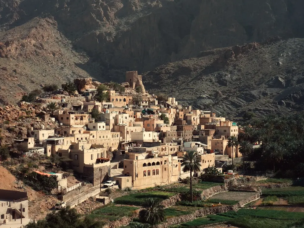
Possibly the most picturesque village in the Hajar Mountains, Bilad Sayt (Bald Sayt on Google Maps) in Wadi Bani Awf is an absolute star. The photogenic views of the terraced fields and pale, stacked pastel houses are postcard perfect and even if you are not a keen photographer, you’ll be snapping away here. This village is what I pictured (hoped) Oman to look like before I arrived.
There are several hiking opportunities from the village, the most noteworthy being the marked W8 trail that leads up the side of the mountain for outstanding views across the entire of Wadi Bani Awf.
If you’re not in the mood to camp, or got super wet in Snake Canyon, there is a newish and very pretty hotel at Bilad Sayt with exquisite views, called the Season Inn Hotel. We saw it being built for the past few years and now it’s open!
CAMPING IN WADI BANI AWF
There are some nice camping spots at the far end of the road in the village of Bilad Sayt. However, our preference is to backtrack around four kilometres through Wadi Bani Awf to a location just outside the west entrance to Snake Canyon, at 23.207395, 57.481156.
Another favourite of ours is to continue along the stunning but steep route through Wadi Bani Awf to camp on the top of the mountains towards Al Hamra and Misfat Al Abriyeen (anywhere around 23.169212, 57.410033 provides absolutely epic views). This is a terrific option during warmer seasons (being 2000 metres up tends to help).
Tip | this day on the off road Oman itinerary has quite a lot of hiking suggested. However, if you are not keen or able to do much hiking, there is an alternative option to use part of your day for a lovely scenic driving route, including an exquisitely beautiful camping spot (23.207395, 57.481156). Just south on the road passing Little Snake Canyon, there is a turn off at 23.231054, 57.425236. This leads to the small village of Al Hijir and then onwards to the Wadi Bani Kharus area, which has several wadis and bustling villages, all backed up against the mighty Jebel Akhdar. It’s a great place to explore with minimal walking.
–

GOT MORE TIME IN OMAN?
Discover some wadis:
Take a look at our 13 favourite wadis
Hike Oman’s favourite Wadi Shab
Live in a fairytale at the Wadi Damm pools
Explore the quirky white pools of Wadi Abyad
or the magnificent waterfalls of Wadi Darbat
Or explore the hubs:
Discover what dramatic means with this Salalah itinerary
See some offbeat spots around Sur
Explore Oman’s cultural heart in Nizwa
Prepare with our Oman driving guide
Max out your time with these Muscat day trips
–
Day 4 – Jebel Shams
〈 Route: Wadi Bani Awf → Al Hamra → Misfat Al Abriyeen → Jebel Shams 〉
Assuming you didn’t choose to camp up there yesterday, continue driving around 13 kilometres past Bilad Sayt through Wadi Bani Awf to the pass at 23.167246, 57.415161. This route is steep with switchbacks and there’s often oncoming traffic. Always keep an eye out for cars and pull over for anyone who is a lot faster than you are.
Trying to keep your eyes on the road during this portion of the road trip is difficult; the vast panoramic views nearing the top of the mountain pass are exceptional. The pass provides some of the best views looking back over Wadi Bani Awf and the entire Hajar Mountains range. It’s a satisfying experience, surveying the region from the top and identifying all the narrow, meandering tracks you traversed the previous day.
There are also some magnificent spots to camp along the ridge here, too.
41 kilometres
Al Hamra
At the top of the mountain, follow the easy paved route down the mountain to Al Hamra. This small town with 400-year-old red (Hamra means red in Arabic) mudbrick houses is a popular stop, and it’s easy to see why. It feels like an old ‘wild west’ type of town, but thoroughly Omani (this is the best way I can think to describe it!).
At sunset, you can watch the men and boys gather to race their horses above the old town at the Al Hamra Viewpoint and have picnics around their cars. It’s magic.
5 kilometres
Misfat Al Abriyeen
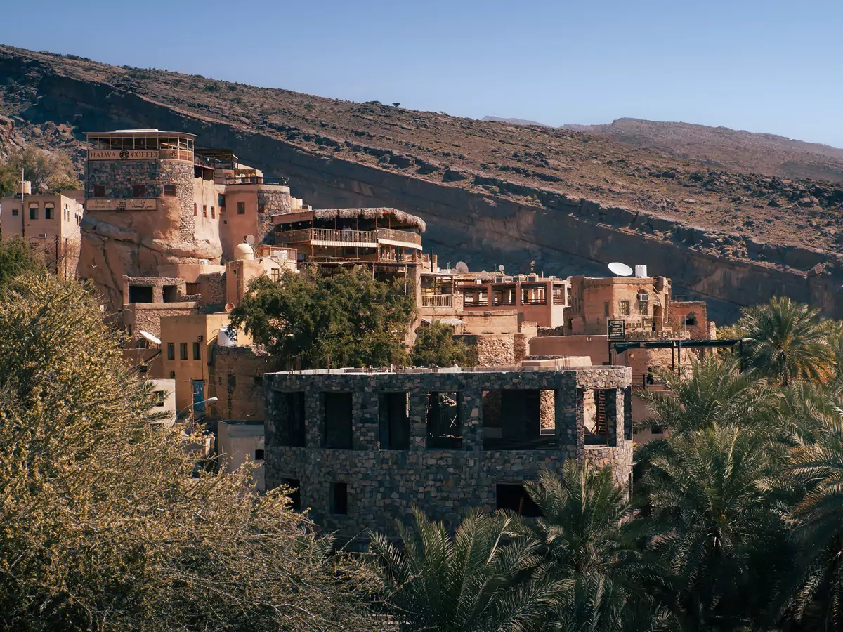
Another historic, postcard-perfect village is the partly abandoned Misfat Al Abriyeen. Surrounded by terraced fields of date palms and fruit trees, interwoven with meandering paths and an intricate falaj (irrigation) system, it is unique in style to the Middle East. This enchanting community is a ramshackle mix of deserted buildings and generational homes. There are friendly guesthouses, welcoming local people, beautiful hiking and, once again, outstanding views!
Parking | parking is along the street; on Google Maps it is marked as ‘Misfat alabriyyn visitor car parking’. There is not much space if lots of people visit at once and parking a large car there was tricky for us. Don’t be obnoxious with parking – some tourists have been known to block the way with their cars (this is what we were told when we visited).
With a four-wheel drive or high clearance vehicle, it is possible to park a little further back along the road, off some dirt tracks and just walk a little further to the village of Misfat Al Abriyeen.
Lodging | if you have a spare day and want somewhere to sleep that is not a tent, consider checking out the historic lodging here. This beautiful cliffside village is well-accustomed to welcoming tourists now, resulting in some decent (if pricey) heritage-type options. If you choose to stay here, we thoroughly recommend Misfah Old House, and if that is sold out (it’s very popular for good reason), then go for Al Misfah Hospitality Inn.
48 kilometres
Jebel Shams
With a summit over 3000 metres, Jebel Shams is the tallest peak in Oman and a popular 4×4 Oman itinerary entry for most tourists.
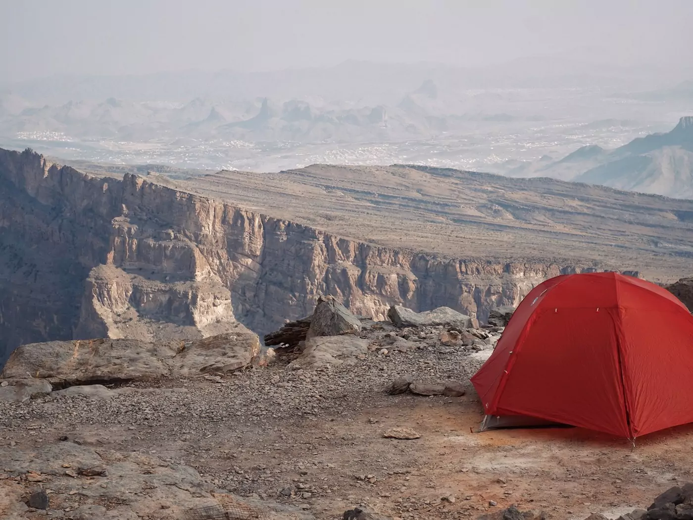
The views are epic, especially during sunrise and sunset over the adjacent Wadi Al Nakhr, known as the Grand Canyon of Arabia. There is panoramic but straightforward hiking, particularly the popular Balcony Walk which traverses the wadi ledges. The camping options are top-notch and, during warmer months, the elevation makes the weather mild compared with the temperatures at sea level.
We have written an entire guide on camping at Jebel Shams if you would like more in-depth information.
Tip | on route to Jebel Shams from Al Hamra, there is a dramatic (but well camouflaged) abandoned cliffside village at Ghul. On Google Maps, it is marked as ‘Valley Necrosis’ and you can get beautiful pictures of it from across the road in a layby. Also, this is the entrance to the bottom of Wadi Al Nakhr. Driving this route is rough, but doable (do not enter if rain is forecast). Looking up the kilometre-high cliffs, you can sometimes spot walkers on the Balcony hike above!
CAMPING ON JEBEL SHAMS
There are loads of places on the canyon rim at Jebel Shams to camp with amazing views. Our favourite is at 23.206645, 57.203446.
Be aware that if you visit Jebel Shams during the depths of winter, it can get extremely cold on the summit overnight. Consider staying in a hotel during this time if you do not have decent three-season camping gear.
–
CAR HIRE FOR YOUR OFFROAD OMAN TRIP
We always rent our vehicles all over the world, including our recent trips in Thailand, Malaysia, Oman, Saudi Arabia, Tunisia, Jordan and Morocco, with Discover Cars. They’re often the most affordable, plus they paid out immediately on an insurance claim we made when our car took some heavy damage in Sicily. We fully recommend them.
–
TAKE A LOOK BELOW OR CHECK CAR RENTAL
Day 5 – Wadi Damm
〈 Route: Jebel Shams → Al Ayn’s Beehive Tombs → Wadi Damm 〉
After watching the sunrise over Oman’s Grand Canyon, head back the way you came up the mountain and at the bottom, take the junction at 23.173523, 57.149126 onto an unsealed road going west. Google Maps is absolutely fine for these roads, just route to ‘Al Ayn’s Beehive Tombs’. From there, it is a short backtrack to Wadi Damm.
If you haven’t yet done the Balcony Hike at Jebel Shams, consider doing that in the morning before departing.
52 kilometres
Al Ayn’s Beehive Tombs
The UNESCO designated beehive tombs at Al Ayn are a 4000-year-old bronze age archaeological site.
Containing 21 (I think) burial tombs against the backdrop of the looming Jebel Misht, this site is a fascinating, if mysterious, stop on the way towards Wadi Damm. Despite containing some of the world’s most complete archaeological structures from the 3rd millennium BCE, Al Ayn doesn’t have any signs or information, just the stone constructions. It’s worth reading up about them in advance if you’re a mega-history buff.
If the beehive tombs are your sort of jam and you have time, check out the archaeological ruins at Bat, too (Bat Tombs on Google Maps). They’re all part of the same UNESCO site. We found the drive out here to be crazy remote (and just a bit hilarious). Occasionally, we’d lose the washboard tracks and were just driving through some desert plains, with no road at all. At one point, Google seriously directed us to an actual pile of bones (who knew it had such a dark sense of humour?).
Don’t be put off though, it was hilarious and we are terrible at route-finding. You’ll do better.
Tip | don’t trust the reviews online for parking a Al Ayn, you don’t need to park on the main road. Pull off and drive along/across the wadi to the entrance at 23.215272, 56.962055 (four-wheel drive necessary). Google Maps gets this slightly wrong.
If you love these tombs, then consider checking out the Jaylah beehive tombs in the eastern Hajar Mountains. These are, by far, the most impressive archaeological site we’ve seen anywhere in Oman, with scenery to match.
13 kilometres
Wadi Damm
One of our favourite days in Oman, hiking to the Wadi Damm pools is a highlight of this off road Oman itinerary that relatively few tourists visit. It is the prettiest wadi we have visited in Oman so far, with an enchanting grotto of ferns, clear green-blue pools and waterfalls. All this, set in a commanding canyon with some (mostly) easy and fun hiking and route-finding!
For full details on the hike and how not to get lost, check out our Wadi Damm Pools hiking guide.
CAMPING IN WADI DAMM
Wadi Damm has some decent enough camp sites, remote but easy enough to access, all set out neatly in a flat area just above the canyon itself (23.233207, 57.091369).
Tip | If you have spare time and don’t want to set up camp too early, it is possible to head back towards Nizwa; there are many camping options along the route that Google sends you back or you could finally succumb to a hotel (Nizwa has a decent selection).
Do not drive back via Sint, the road that runs south of the town is spectacular but abruptly ends with a bunch of warning signs – Google Maps gets this one wrong, too. There are stunning camping opportunities down the road passed Sint though (I guess because nobody goes there due to the dead end?).
–


Day 6 – Nizwa
〈 Route: Wadi Damm → Nizwa → Mountains (Optional) 〉
Drive to Nizwa after your camp at Wadi Damm. The route is straightforward – take a look at the tip above.
118 kilometres
Nizwa
There’s a lot of interesting, traditional, touristy things to do in and around Nizwa, including exploring the ancient old town, souq and Nizwa Fort (5 OMR entry). We recommend visiting on a Friday, if possible, in order to check out the busy morning livestock market.
Options around Nizwa include the abandoned village ruins of Old Manah (2 OMR entry), checking out the bombed village of Tanuf (free), Jabreen Castle (3.15 OMR entry) and Bahla Fort (3 OMR entry). You could easily make a day of all these sites and stay in a Nizwa hotel overnight and get a cooked meal.
Check out our post on all the things to do around Nizwa for loads more ideas.
– Hotels Around Nizwa –
If you’re considering a well-earned hotel, we’ve stayed in a lot of accommodation around Nizwa and recommend the below:
Upper Mid-range (+$$) | IntercityHotel Nizwa – the most modern hotel in Nizwa, with clean, simple rooms and super easy parking right next to a Lulu Hypermarket and the Nizwa Grand Mall. This hotel goes up in price *a lot* last minute, so if you’re looking to book, do it early.
Mid-Range ($$) | Antique Inn – quirky heritage hotel with some serious character, adjacent to Nizwa Fort and Souq. Parking can be a little tight if you arrive late in the evening and some rooms don’t have a window – upgrade to a King Suite if you can (I think the double rooms in this hotel are a little overpriced). Breakfast is excellent and the views of Nizwa old town from the terrace are fantastic.
Lower Mid-Range (-$$) | Nizwa Inn – simple, clean and friendly hotel with nice modern rooms, ours always had nice views across the desert towards the mountains. The entrance is a little slippery, be careful! The location is super-convenient, right opposite the Nizwa Grand Mall.
CAMPING AROUND NIZWA
To continue the camping theme on this off road Oman itinerary, this is one of our favourite options outside Nizwa. After checking out any of the above sites in Nizwa that interest you, take a steep, winding trip up into the mountains, around 50 kilometres north of Nizwa. The dirt road in the mountains begins at 23.061266, 57.426863. The Tanuf ruins and Wadi Tanuf are en route, so consider checking them out.
Be aware that the road appears to have recently been remade, so Google does not have the exact correct route. Check the roads out on Google Satellite to see the correct one. The town at the end is not named on Google Maps, but is located at 23.140135, 57.472000.
It’s easy to find camping up here, just off the roads. We didn’t see a single other person the entire time we were there, and the vistas and sunset were incredible. We camped at 23.120282, 57.457441.
–

GOT EVEN MORE TIME IN OMAN?
Go camping:
Sleep under the stars at these amazing wild camping locations
Plan your trip with our Oman camping guide
Camp atop Oman’s highest mountain
or camp in the palest of Oman’s deserts at the Sugar Dunes
or have a totally unique adventure:
Spot the most remote beehive tombs in Oman
Wander around Oman’s most photogenic fort
Learn about livestock at the Nizwa goat market
Take a look around Oman’s most unique fortification
–
Day 7 – Back to Muscat
〈 Route: Nizwa → Wadi Qurai → Samail Castle → Muscat 〉
The final day of this 4×4 Oman itinerary is a leisurely drive back to Muscat on Highway 15. The route is quite scenic and passes through some larger towns and shows off a different, more modern side of Oman that is not so apparent in the mountains. Several quick stops on this route include Wadi Qurai (if you fancy a short hike) and the stunningly photogenic Samail Castle.
The morning could be spent checking out some of the sites missed on previous days around Nizwa, as mentioned above, or time could be spent exploring Muscat. A walk along the Mutrah Corniche in Muscat is an especially lovely way to end an afternoon; the Sultan Qaboos Grand Mosque is also incredible but shuts to visitors at 11am daily (closed on Fridays, free entry).
HOTELS AROUND MUSCAT
Muscat is the closest major city to Wadi Al Abyad and most tourists will visit from there.
We recommend these hotels in Muscat (we’ve stayed in lots and lots of hotels in the capital and know them well):
Super Upper-Range ($$$$): Al Bustan Palace – outrageously beautiful scenery accompanies even more outrageously beautiful rooms. Nestled into the mountains on a stunning beach along the coast to the east of Muscat – if you can afford this one snap up a room without question. I’d live here and never leave.
Mid-Range ($$): Royal Tulip Muscat – centrally located in Al Khuwair, near malls and some of our favourite restaurants, with classy, great sized rooms and underground parking. This hotel is almost always a bargain for the price you pay.
Lower Mid-Range (-$$): Al Murooj Grand Hotel – surprisingly lovely rooms for the very reasonable price (they smelled amazing too!), easy parking, friendly staff. Good central location too.
Lower Mid-Range (-$$): Citadines Al Ghubrah Muscat – excellent little apartment rooms, perfect if you live out of the supermarket like we do! Once again, fantastically located in a quiet area just outside the busy Al Khuwair area.
Budget (+$): Swiss-Belinn Airport Muscat Oman – outside of Muscat, near the airport but cheap as chips for the money if you have a car to get around. Really decent modern rooms, easy parking and all-around pleasant stay.
–


Off Road Oman Google Map
Below is a savable Google Map marking everything mentioned in this itinerary.
To save the map, select the star next to the title.
BEST TIME OF YEAR FOR AN OMAN OFF ROAD TRIP
This itinerary is a little more flexible than other camping holidays in Oman.
It permits camping further into summer since a lot of the options are in the mountains as the elevation helps counter the warmer temperatures. However, between December to February the higher elevations can be very cold, sometimes even icy. Consider your outdoor gear carefully if you are going during these months.
The best months to visit Oman for this trip are during the shoulder seasons of October-November and end of February to April. These will have moderate temperatures both up the mountains and at sea level.
We camped in February and March using our standard 3-season lightweight gear. There were no issues with temperatures at any time, in fact it was mostly pretty warm.
–
15 PLACES TO VISIT IN SALALAH | SAFETY IN OMAN
HAS OUR FREE CONTENT HELPED YOU PLAN AN ADVENTURE AROUND OMAN’S MOUNTAINS?
If you’ve found our content helpful, consider booking your rental car (if you need one!), through the company we always use – Discover Cars. They’re the absolute best and have been our rental companion (and savior, thanks to their insurance) in many destinations across the world.
Also, consider booking your accommodation through Booking.com – we use them exclusively when travelling in the Middle East.
Help like this makes it easier to pay for the upkeep of this site. Thank you!
–
Final Thoughts – Off Road Oman Itinerary
A logical off road journey through Wadi Bani Awf and the surrounding Hajar Mountains is a tricky one to plan. It took us quite a lot of time to really get to grips with the best routes through the mountains in Oman and which directions made the most sense (we took a far longer, less elegant and logical route than the one detailed above on our first visit). We hope it helps you plan!
We wholly encourage you to prioritise Wadi Bani Awf and the Hajar Mountains on your off road Oman journey, you won’t regret it. It’s one of the most breathtaking areas we have ever visited
Have an incredible trip!
Hi, thanks for visiting our blog! If this post has been of help to you, or you’ve just enjoyed our random ramblings and musings, say thank you by buying us a coffee! It helps keep The Restless Beans blog up and running.
Thank you, Claire + Nick


Hello, thank you for all the details. I have one question. Do you think it’s possible to get from Wadi Damm to Wadi Ghul using car without 4WD, for example Duster. I see there’s 11km of unpaved road east from here: 23°09’46.9″N 57°04’24.6″E
Thank you so much! Yes, I think it will be fine, especially since a Duster has a reasonable clearance. Although it is about 10.8 kilometres of dirt road, it is not very steep or difficult (it was quite smooth when we were there). You definitely will not need a full four-wheel drive! Hope that helps your planning 🙂
Hey, thank you for this awesome blog. We rented a 4×4 car and had no plans, but your blog was a life saver. It was super nice to have all the coordinates so we didn’t have to worry about or spending time to find good camping spots. We had a super relaxed holiday (ok besides driving up the wrong scary road or the night we were camping in the wadi in wind and rain with a flood warning)! We did not have as much time like you, so with your help we didn’t waste any time and had a great time. We mainly followed your blog, although some days we were a bit slower, while others a bit faster because we skipped some places. We definitely had higher water levels than during your visit, like some of the swimming places we thought we could not find, but they turned out to be much rougher so we did not immediately recognize them from your photos and could not swim in it. But there was always another nice spot right around the corner!
We did go the desert at the end of the week and spent a night there as well. I think that was a great addition to our holiday!
We really loved our time in Oman! Thank you!
Hi Marie,
Thank you for your lovely comment and sharing your own experiences off-roading in Oman.
Hi!
Your blog is very helpful for planning tip to Oman.
Do you have coordinates for North entrace in Snake Canyon?
Thanks
Hi Vadis,
Thanks for your comment.
The entrance to the north of Snake Canyon is around 23.212773, 57.403745.
Hope this helps. 🙂
Hi there! Great blog and coming handy as we are also looking into doing adventure trip to Oman. I know this is all about wild camping, but are there other accommodation options for the Blue route if we follow your itinerary? We are looking at travelling in Dec/Jan so would be a bit colder in the mountains, and looking at not traveling with lots of equipment.
How does the water in the wadis feel in the winter? Especially those at higher altitude