

Journey to Jaylah: Oman’s Most Remote Beehive Tombs
Scribbled by Claire ⬩ 14 Aug 2026
Read on for a little hidden magic in the northern Omani mountains – the Jaylah Beehive Tombs – with all the information on how to reach them, some folklore, a dash of history, car requirements, a map, and more.

Rumbling along the gravelly washboard track through deep, sand-coloured valleys, I am distracted by the hazy scenery surrounding me. I don’t immediately notice the formations looming along the cliffs beyond us; semi-regularly spaced, unnaturally so, and too large to be rubble.
As we drive closer, these stony mounds come into sharp relief; they are perfectly constructed, conical towers. Right here, in the middle of nowhere; a place so remote I hadn’t seen another person in hours. This was my first encounter with the incredible, millennia-old, Tower Tombs of Shir.
Also known as the Jaylah Beehive Tombs, these archaeological remnants are hidden away, high in the peaks of one of the least-frequented corners of the eastern Hajar Mountains. If I’m being honest, I had minimal historical knowledge about these remarkable, 4000-year-old tower tombs during my first visit. I learnt more about them after; a place I have since returned to, several times, despite the significant effort in reaching it.
They’ve possessed a little part of my mind.
This magical mountainous region, complete with beehive tombs, is ideal if you are looking for a remote, off-beat, exquisitely beautiful adventure in Oman. The backdrop is epic and you can even wild camp, completely alone, within a few metres of these remnants that have been around for millennia. It’s a little spooky! Where else in the world can you do that?
Here is all the information I have, including their location, how to access the tombs and a million photos that I hope inspire you to visit!

IN THIS GUIDE //
Oman’s Most Remote Beehive Tombs
Where are the Jaylah Beehive Tombs?
How to Access the Jaylah Beehive Tombs
– Fins and Tiwi to Jaylah
– 1. Fins to the Jaylah Beehive Tombs
– 2. Tiwi to the Jaylah Beehive Tombs
– 3. Qalhat to the Jaylah Beehive Tombs
From Ibra to Sur Via Jaylah
– 4. Ibra to the Jaylah Beehive Tombs
Jaylah Beehive Tomb Routes – Map
What we Know About the Beehive Tombs
– Construction and History
Terminology: Tower Tomb or Beehive Tomb?
The Story of a Demon
Where to Stay for the Jaylah Beehive Tombs
– Camping Near the Beehive Tombs
Things to do Nearby
Final Thoughts – Jaylah’s Beehive Tombs
This post may contain affiliate links. If you book through these links we may make a small commission at zero cost to you. It helps us pay for the upkeep of this blog. Thank you!
Where are the Jaylah Beehive Tombs?
These ancient tombs (also labelled as The Graves of Kubaikib on Google Maps) reside in northern Oman.
They are situated in the Wiliyat of Sur, Ash Sharqiyah North Governorate, in the stark, unforgiving eastern Hajar Mountains that fringe the Gulf of Oman.
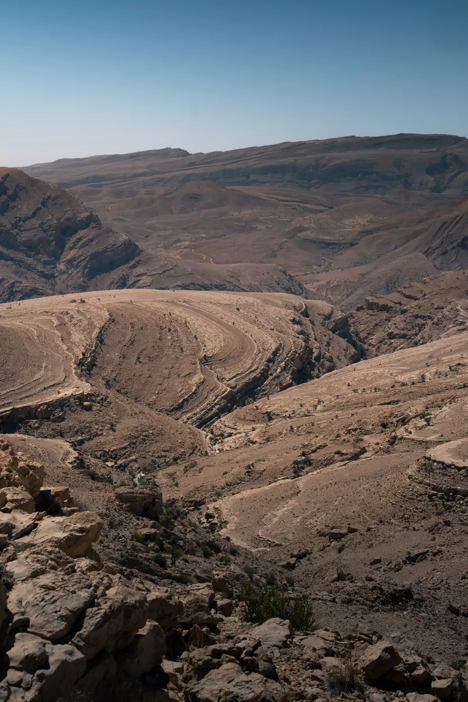
The terrain is challenging and rugged; on one side are several dizzying routes to the ocean and the tiny towns of Tiwi and Qalhat, the other a steep mountainous track leading to the inland town of Ibra.
How to Get to the Jaylah Beehive Tombs
Access to the tombs from both the east and west side of the Hajar Mountains is four-wheel drive, high clearance only. There are three routes from the coast, and one main route inland from Ibra.
Although the route to the Jaylah Beehive tombs is rugged, these roads are some of my favourites I’ve ever driven in Oman. If the scenery around the tombs is magnificent, the scenery getting to-and-from them is even more so.
These roads may be challenging if you’ve not driven in mountainous terrain before, especially if you are heading to or from the coast along the Muscat-Sur Coastal Highway.
We’ve written about the various routes to the tombs below. There are four main options: three from the east (from Fins, Tiwi and Qalhat) and one from the west (via Ibra). Route from your starting point to ‘Jaylah Beehive Tombs‘ on Google Maps – that takes you to the correct location.
Fins and Tiwi to Jaylah
There are two coastal routes situated either side of Fins White Beach that lead up onto the Salma Plateau, one near Tiwi and the other near Fins.
Both roads are extremely steep, narrow and nerve-wracking if you are afraid of heights. It’s not for the faint-of-heart (especially the southern route from the Muscat-Sur Coastal Highway).
They make for a great circular route, as these roads ascend and descend just six kilometres from each other!


1. Fins to Jaylah
The route from Fins to the Jaylah Beehive Tombs begins at 22.915532, 59.193905 and is the easier option up to the mountain plateau (in my opinion). It leaves the Muscat-Sur Coastal Highway adjacent to the the village of Fins. The route is mostly straightforward, with some steep switchbacks part way up.
It is about 32 kilometres and takes around 1.5 hours to reach the Jaylah Beehive Tombs without stopping.
2. Tiwi to Jaylah
Beginning at 22.870281, 59.222764, the route from Tiwi to Jaylah is about 30 kilometres and takes 1.5 hours, but with a few more wiggles. I’d ascend this route and descend via the north route, given the choice (if you’re thinking of doing a loop).
This route has some particularly pretty mountain-coastal scenery from the top, plus a cool ledge-like road with epic views.
I’ve always found this road to be the lesser travelled of the two.
3. Qalhat to Jaylah
An alternative coastal route to the Jaylah Beehive Tombs is the longer option from Qalhat. It begins at 22.695571, 59.367398, just opposite the Bibi Maryam Mausoleum which is part of the Qalhat UNESCO World Heritage Site.
This has incredible scenery (some of the best in the mountain range) and I prefer it to the Salma Plateau roads. The drive up (or down) the mountain by the coast at Qalhat is also a little less steep than from Fins and Tiwi. Check out the Google Map below – it marks all the route options.
From Qalhat, it takes about 2.5 hours to reach the Jaylah tombs and the route is about 60 kilometres.

4. From Ibra to Sur via Jaylah Beehive Tombs
The journey in either direction between Sur and Ibra via the Jaylah Beehive Tombs takes around four hours without stopping (depending on how fast you are willing to drive the rougher tracks).
Be aware that if you are heading towards Sur, you do not want to be descending the mountain towards the coast at night. This means leaving the Jaylah Beehive Tombs around two hours before sunset, to be safe.
4.1 From Ibra to the Jaylah Beehive Tombs
The route from Ibra to Jaylah takes around 1 hour 45 minutes to drive and is about 85 kilometres.
It’s very simple, flat and paved from Ibra until the village at 22.889457, 58.894458 (nearly 60 kilometres of the total!). The rest of the unpaved roads are well-used and straightforward.
To head onwards to Sur from the beehive tombs, follow any of the three routes mentioned above (Tiwi, Fins or Qalhat) to reach the Muscat-Sur Road (Route 17), then drive south.
This is such a cool day trip!
CAR HIRE FOR A RUGGED OMANI BEEHIVE EXPEDITION
We always rent our vehicles all over the world, including our recent trips in Oman, Saudi Arabia, Tunisia and Morocco, with Discover Cars. They’re often the most affordable, plus they paid out immediately on an insurance claim we made when our car took some heavy damage in Sicily.
Read more about why we totally recommend them!
–
TAKE A LOOK BELOW OR CHECK CAR RENTAL
Jaylah Beehive Tombs Route: a Google Map
Below is a saveable Google map which describes the various routes mentioned above.
The blue lines all show the four routes to the Jaylah Beehive Tombs: starting at A (Ibra, Qalhat, Tiwi and Fins) and ending at the tombs (B).
To save it, select the star next to the title.
GOT MORE TIME IN OMAN?
Explore some wadis:
Take a look at our 13 favourite wadis
Hike Oman’s favourite Wadi Shab
Live in a fairytale at the Wadi Damm pools
Drive through rivers in Wadi Dayqah
Explore the quirky white pools of Wadi Abyad
or the magnificent waterfalls of Wadi Darbat
Explore the cities and mountains:
Feel intrepid on an Oman offroad mountains itinerary
Discover what dramatic means with this Salalah itinerary
See some offbeat spots around Sur
Explore Oman’s cultural heart in Nizwa
Prepare with our Oman driving guide
Max out your time with these day trips from Muscat
Check out Muscat’s best viewpoints
Have the best two-day city break in Muscat
–

IBRA, OMAN
Visitors to Oman rarely stay in Ibra. However, it is a useful place to stop between Sur and Nizwa, with modest hotels and a massive Lulu hypermarket.
We’ve stayed at Al Mustaqbal, a friendly little hotel with comfortable rooms. We’d recommend it for a stay in Ibra.
The town is about a onehour drive north of Wadi Bani Khalid (30 minutes closer than Sur), which is great if you intend to arrive early in the morning to avoid the crowds. It’s also only half an hour away from Bidiyah; useful if you want to get to Wahiba Sands early to cross the desert.
If you are in Ibra on a Wednesday, check out the souq which is entirely run by women!
–
RELATED | OMAN’S CURIOUS WHITE WADI POOLS
What We Know About Oman’s Beehive Tombs
The mysterious relics near Jaylah were exposed to the wider world by a British aviator called John Nowell, who prompted an exploratory voyage by the German Archaeological Institute in 1991. Before that, access was via a track up to the plateau that was only constructed in 1985, allowing vehicular access for the first time.
Although the UNESCO beehive tombs at Al Ain and Bat in the western Hajar Mountains are more well-known, the beehive tombs at Jaylah are far better preserved and generally more of a spectacle. The location is more isolated, meaning they have been only minimally interfered with as myths surrounding the tombs kept local villagers at a distance.
History and Construction of the Jaylah Beehive Tombs
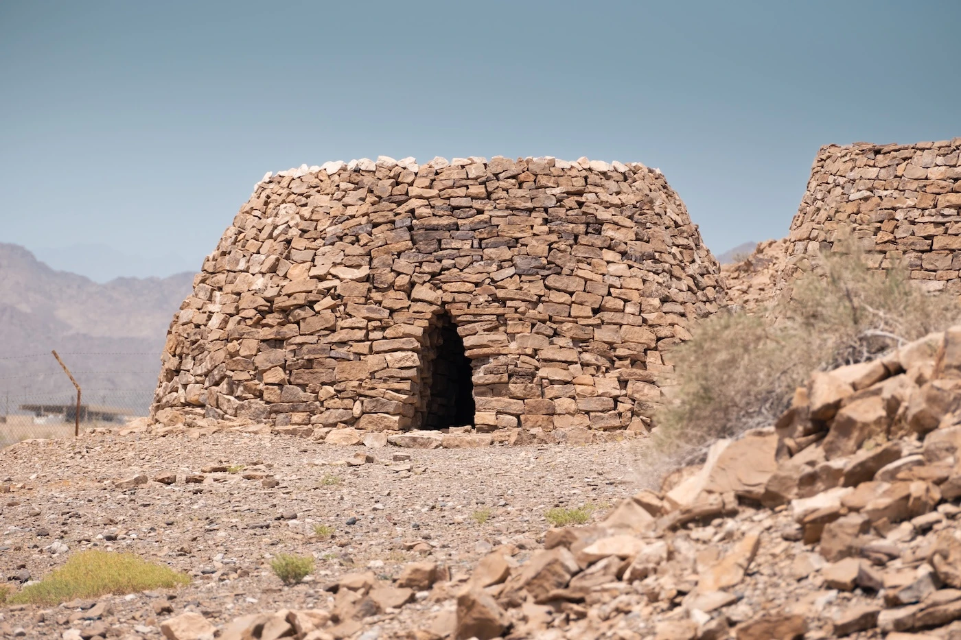
There are around 60 Bronze Age tower tombs spread out around Jaylah, estimated to be around 4000 years old. They’re meticulously constructed from spiralling stacks of flat limestone rocks (the pictures explain this far better than I can). They have dimensions of up to eight metres high, are several metres across and most have a small entrance which faces east. These imposing constructions trace the cliff-edges, in intentionally commanding positions overlooking the valleys below. Inside, skeletal remains and pottery were discovered by the German team.
Some of these prehistoric ruins are believed to go back to the Umm Al Nar culture, meaning Mother of Fire. They are a Bronze Age people that existed between 2600 and 2000 BCE, whose name comes from an island near Abu Dhabi, U.A.E., where their remains were first identified.
It is believed that some of the more irregular tombs were built as far back as 3000-2500 BCE during the older Hafit Period (named after Jebel Hafeet in the U.A.E. where more tombs have been discovered).


TERMINOLOGY: TOWER TOMB OR BEEHIVE TOMB?
So, I thought these were all the same thing, but apparently not. It turns out the tombs at Shir/Jaylah are not all identical. In fact, there are five different types of structure, with different walls, entrances and dimensions. These are not all built by the same people around the same time!
The two main types of tombs are the Hafit beehive and Umm an-Nar tomb.
In order to accurately describe these ruins chronologically, we should use more appropriate descriptors. The author of the 1990s German academic paper suggested that as a generic description, we should just call them cairns, which are simply ‘heaps of stones’!
–


The Story of a Demon
In the surrounding region, the local legend is that the stone tower tombs were constructed by a demonic spirit or ‘jāhil’ (an unbeliever) named Kebir Keb (or Kubaikib). Each of the small villages in the vicinity tell a slightly different tale, but they all involved the demon who lived in the towers.
The story of Kebir Keb starts with a local goat herder who stumbles upon a beautiful jinn (anglicised: a genie) at a waterfall. She was angry at being observed but didn’t kill the goat herder as he reminded the jinn of her son and she believed in Allah. Instead, she shared a secret with him:
At the place of the towers, there is a jāhil called Kebir Keb, who guards his realm with a sword. His eyes are open as he sleeps; his eyes are shut when he is awake.
Knowing this, the goat herder snuck into the towers, checking that the eyes of the demon were open. He stole the sword but awoke the demonic Kebir Keb. The goat herder ran away and was pursued. Hiding in a cave until it was safe, he returned and beheaded the demon, only to find that the jāhil did not die.
It is said that cutting the demon would make him become double, so the goat herder did not attack again. The jāhil’s legs fell, but the torso chased the goat herder. The goat herder ran away to a nearby town, and the torso died nearby and was buried.
This is where the tale stops. The men recanting it could not recall any more detail; it resides with their grandfathers.
According to some stories, the jāhil was a highwayman, living only around 200 years ago. He was ‘gigantic in stature’ whose arms could reach to Ibra and legs to Wadi Bani Khalid. In the present day, there are two documented graves for Kebir Keb, in separate neighbouring settlements. One burial site contains his legs, the other his torso. The graves are isolated and also set on red ground, both of which are uncommon for Islamic burials (green is commonly considered the colour of paradise). Contrastingly though, both graves are oriented towards the Qibla (the direction of Makkah).
The stone towers have long been attributed to the jāhil in the local region, with varying versions of this tale being told.


Where to Stay Near the Jaylah Beehive Tombs
A journey from Ibra to Sur (or vice-versa) makes for a tremendously memorable day trip. Both towns have decent hotels, supermarkets and facilities, so no problem if you are not a camper!
We recommend (and have stayed in):
Camping Near the Beehive Tombs
There are also camping options in many places between the two cities. If you are ending at the coast near Sur, anywhere along the Fins shoreline or down towards Qalhat is a popular place to camp (a superb option for the milder winter months).
Throughout the warm, soupier summer months, the coast gets pretty yucky and camping up in the mountains is far more pleasant due to their elevation (several thousands of metres up!). Conversely, in the winter months, the mountain option can get chilly, so take appropriate camping equipment (we use three-season lightweight gear for all our camping in Oman).
There are various options to camp within the actual tombs area, too. As you drive by and check them out, you’ll spot flat, cleared regions to pitch a tent and park your car. An example camping location is here: 22.807037, 59.069229.
Please don’t mess with the ruins or burn a fire too close to them if you camp here.


Things to do Nearby
⬩ Sur: the nearest major town, situated to the south along the coast. For more information, check out our list of things to do in Sur.
⬩ Wadi Shab: one of Oman’s most popular wadis. For information on hiking, parking, costs and logistics, check out our Wadi Shab guide.
⬩ Bimmah Sinkhole: a bright blue sinkhole, right on the coast. We don’t overly rate it but foreign tourists go absolutely mad for it.
⬩ Wadi Tiwi: accessed by a rough, steep, narrow four-wheel drive track – this popular wadi is worth the effort.
⬩ Beaches: the entire coastline between Muscat and Sur is mostly craggy cliffs and beach! Check out popular spots around Tiwi, Fins and Qalhat. For more beachy information, have a look at our post on the best beaches across Oman.
⬩ Qalhat: a UNESCO World Heritage Site and home to the Bibi Maryam Mausoleum. There is also an opportunity to do a bit of a fun, scrambly hike through the wadi at Qalhat. There were a few pools when we visited at the end of the dry season – and zero other people.
⬩ Wadi Al Arbeieen and Wadi Dayqah: two of my favourite wadis – especially Dayqah. If you are driving from Muscat, don’t miss the bright green Dayqah Dam either – it’s Oman’s largest.
⬩ Wadi Bani Khalid: a popular family-friendly wadi, just an hour from Ibra.


GOT EVEN MORE TIME IN OMAN?
Go camping:
Sleep under the stars at these amazing wild camping locations
Plan your trip with our Oman camping guide
Camp atop Oman’s highest mountain
or camp in the whitest of Oman’s deserts at the Sugar Dunes
or have a totally unique adventure:
Wander around Oman’s most photogenic fort
Learn about livestock at the Nizwa goat market
Take a look around Oman’s most unique fortification
Take a chill day at some of Muscat’s best beaches
Drive up Oman’s most popular mountain
Find a way into Bat’s 5000 year-old tombs
Figure out which of Oman’s UNESCO sites are worth visiting
Take a chill day on one of Muscat’s beaches
–
Final Thoughts: Visiting Jaylah’s Beehive Tombs
I’m not exactly a history buff (although a bit of knowledge goes a long way in enhancing interest in a location). These beehive and tower tombs are special though for some reason and really inspired me to learn more. It’s also an adventurous, remote journey that is as rewarding as the destination (the best parts of travel often are!).
Perhaps some might find this place less inspiring, I’m not sure, but I loved it and believe that many others may feel similarly to me. If you are planning a trip to Oman with a four-wheel drive vehicle, we really encourage you to spend time in the eastern Hajar Mountains. They’re less popular than their western counterpart near Nizwa but have a charm and beauty that is uniquely their own. Plus, a fraction of the people (which is almost nobody anyway).
We hope, if you decide to visit, that your trip is as amazing as ours!
If you’re visiting from Muscat, check out our other favourite day trips from the capital and our detailed two-day itinerary.
Hi, thanks for visiting our blog! If our free content has been of help to you, or you’ve just enjoyed our random ramblings and musings, say thank you by buying us a coffee! It helps keep The Restless Beans blog up and running.
Thank you, Claire + Nick





Wow! I love that you wrote so extensively about this site with the beehive tombs. Thanks for all the info. We saw the ones at Aïn, and haven’t gotten around to cross this part of the mountains yet. Definitely on the list when we ever return to Oman!
Thanks so much, really appreciate your comment. They’re really worth a visit – the whole region is!
Jahil means someone lacking knowledge or uneducated. That’s why in Kuwait children are called yehal in plural ans yahil singular. In Kuwait the J is pronounced y. Pre-islamic culture is refered to days of jahilliya or days of pre-enlightenment with knowledge of Islam. As a native Omani and native Arabic speaker I find the story doesn’t fit the language. Although there is a local culture of making up jin stories to scare tourists and this is almost a national pass time with extra points scored for how gullible the tourist is. Might be the story you were told is a mix of local legend and our favorite sport of telling ghost and witchcraft stories with extra points scored for getting you hooked till the end