

A Detailed California Highway 395 Road Trip: Itinerary and Guide
Scribbled by Claire ⬩ 28 Mar 2026
Are you looking for the most scenic part of California for a road trip? Well, Highway 395 along the eastern Sierra Mountains wins, hands down! This itinerary covers all of the most beautiful, interesting, and bizarre spots, so you can plan your perfect journey.
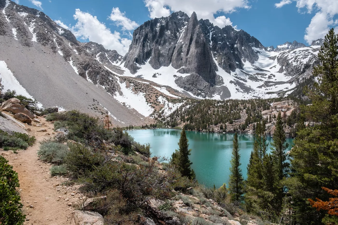
The entire State of California is magical, especially for road trip and outdoor enthusiasts (and I definitely consider myself one of these).
If you have to pick one section of the state for your road trip (California is massive, after all), we’d highly recommend the eastern Sierra Nevada range along Highway 395, between Death Valley and Lone Pine in the south, to Lake Tahoe and beyond in the north. It’s one of the most scenic, varied, and dramatic road trips we’ve ever taken anywhere in the world.
This route passes through some of the United States’ best alpine scenery, the ghost town gold rush centre of Bodie, volcanic bubbling rivers near Bishop, the classy ski resorts and lakes of Mammoth, and the curious rock formations and film locations of Alabama Hills.
There are the world’s most ancient trees, California’s epic hiking trails, an outstanding bakery, one of the United States’ most popular national parks, and the highest peak in the contiguous USA, Mount Whitney.
It’s just a very, very cool place to explore by road for a week or two.
If you’re lucky, you might even bump into a few long-distance Pacific Crest Trail hikers, and they always have the best stories. You may even see a bear or two.
We’ve driven this route five (or more?) times now, hitting all the best (and lesser-known) spots along the way. We’ve done it with a tent and without, with and without hiking, at various times of year, so can cover all the travel styles here!
This detailed itinerary and guide, accompanied by loads of photos, is designed so you you won’t miss anything, whether you have a week, two, or even more to spend in this epic region!

IN THIS GUIDE //
Roadtripping California’s most scenic highway
About this Route and Itinerary
Car Requirements
Optional Stops at the Beginning
Lone Pine
Big Pine
Bishop
Mammoth
Optional: June Lake
Mono Lake
Optional: Yosemite National Park
Optional: Saddlebag Lake
Bodie Historic Ghost Town
Lake Tahoe
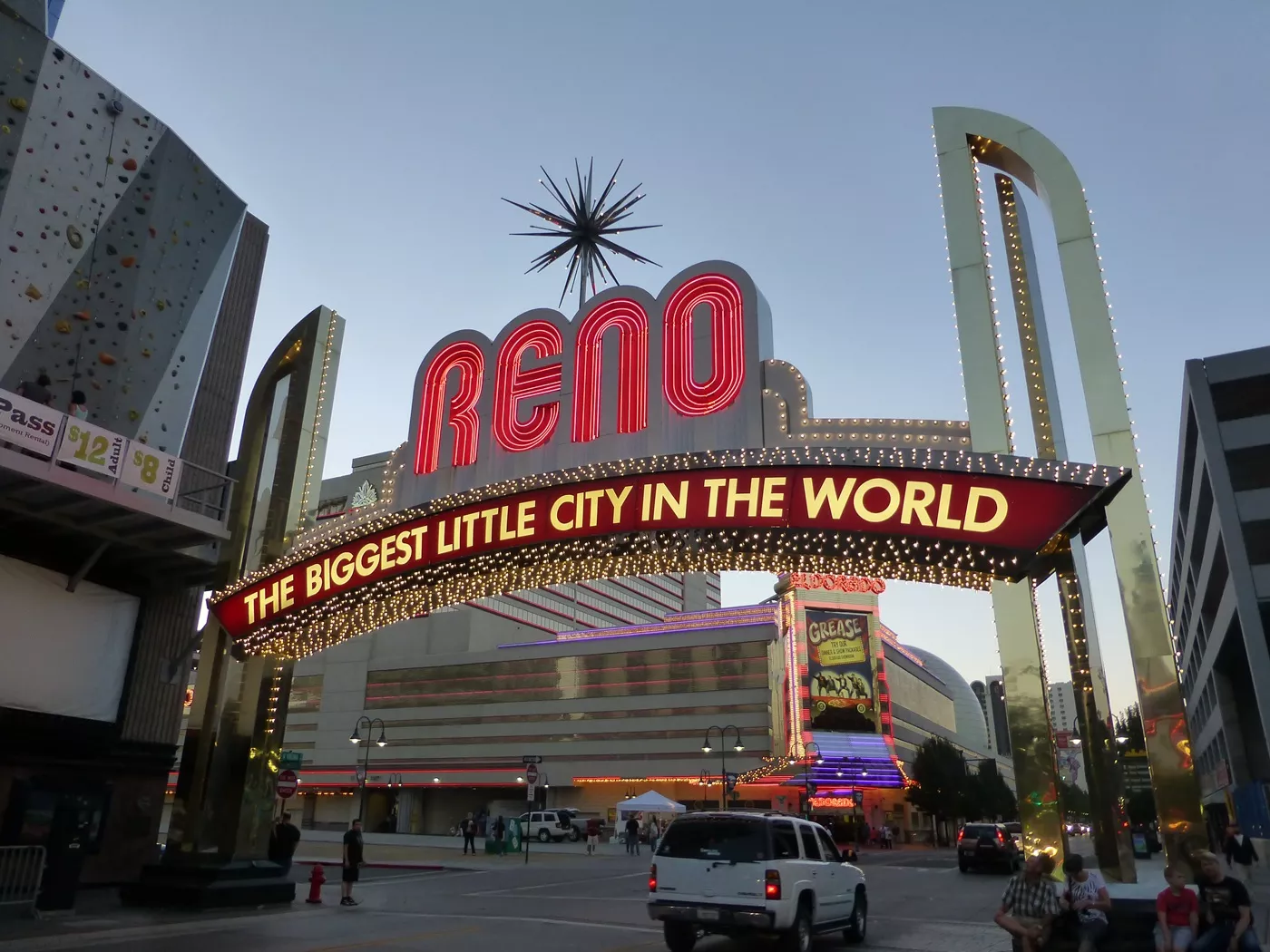
Optional: Reno
Itinerary Google Map
Best Time to Visit
Where to Next?
This post may contain affiliate links. If you book through these links we may make a small commission at zero cost to you. It helps us pay for the upkeep of this blog. Thank you!
TWO WEEK ITINERARY OVERVIEW
Day 1-2: Lone Pine
Day 3: Big Pine
Day 4: Bishop
Day 5-7: Mammoth Lakes
Day 8-10: Yosemite
Day 11-14: Lake Tahoe
Optional: Reno
–
ONE WEEK OPTION
Day 1-2: Lone Pine
Day 3: Big Pine and Bishop
Day 4-5: Mammoth Lakes
Day 6-7: Lake Tahoe
Optional: Reno
–
This Route and Itinerary
The itinerary can be undetaken in either direction, but we’ve written it from south to north since most people start in Los Angeles or Las Vegas, in the south. Simply reverse the journey if you’re coming from the north!
It’s a one-way route, so there are optional extras at either end, a few of which we’ve mentioned (which will depend on your finishing point). This road trip can even be a smaller section of a much longer trip around California or the southwest United States.
We’d recommend spending a minimum of a week in the eastern Sierra Nevada region, or closer to two if you hike and camp a lot. We’ve put recommendations for things to do and how long they might take, but remember to consider timings for longer hikes and related rest days (only you know your stamina and fitness!).

Car Requirements
You will need a rental car for this trip (if you don’t have your own), but it doesn’t need to be a four-wheel drive or high clearance. The roads along this route are mostly all paved, apart from a small section up to Bodie Ghost Town, but any car type can manage those particular miles of road.
There are a few other unpaved sections for some side quests, but we’ve mentioned the state of all the roads whenever relevant, and nothing requires a four-wheel drive vehicle.
Everywhere we list has free parking, even within the towns (unless we note otherwise).

Optional Stops at the Beginning
From Los Angeles
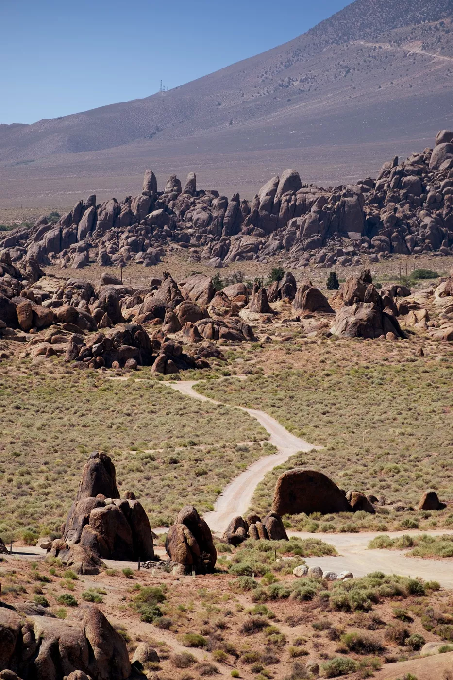
If you’re driving from Los Angeles, consider stopping off on the way to Lone Pine via Red Rock Canyon State Park. It’s a great spot for camping, hiking and exploring on foot and is just south of where Highway 395 begins.
It’s been a while since I was there, but I remember loving the first-come, first-serve campground – the sites remind me a bit of Goblin Valley’s campground and the weird, alien like terrain reminds me of a more colourful Cathedral Gorge State Park.
If you’re wanting a tiny bit of the classic Utah southwest vibes on your way to the Sierras, stop here for a few hours. There’s a day-use fee of $6 per car.
From Las Vegas
If you’re driving from Las Vegas, the best route is straight through Death Valley National Park.
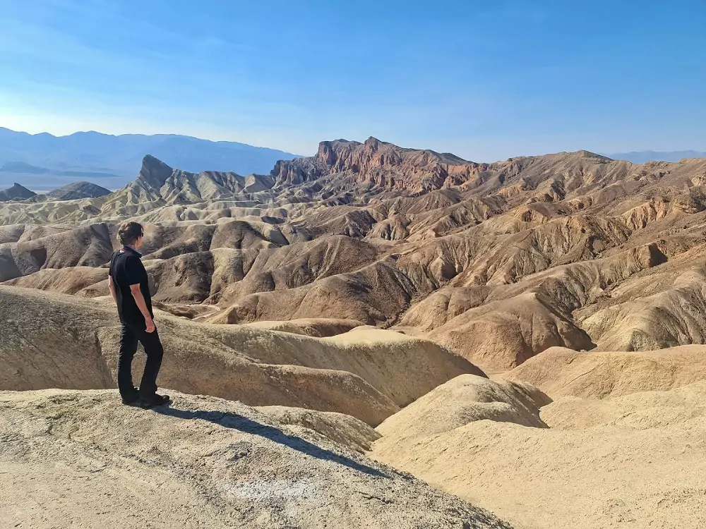
The drive to Lone Pine goes directly through some of the more famous parts of the park, like the Mesquite Flat Sand Dunes and Stovepipe Wells. With a smallish detour, you can visit Zabriskie Point, Dante’s View, Artists Palette, Furnace Creek and Badwater Basin, the lowest point in North America at 86 metres below sea-level.
It makes sense to schedule in a few hours (absolute minimum) on the way if you have time! If you are visiting in summer, be aware that Death Valley is one of the hottest places on Earth – it’s honestly pretty dramatic just getting out of the car!
If you take the route through Beatty, this road trip also passes through the quirky ghost town of Rhyolite, which is also worth a look. We stop every time.

Day 1-2: Lone Pine
Lone Pine is the first town on this itinerary and one of the best stops in my opinion. There are so many things to do here, whether you’re a hiker, museum buff, or photographer.
It’s a tiny little place but sees a lot of people passing through, so has a moderate range of amenities.
Below are some of the best things to do over a few days in the area.
Mount Whitney (2+ hours)
This is the United States’ tallest mountain (outside of Alaska).
You can drive up and see it from the base (you can also easily see it from the Alabama Hills area, mentioned below). While there, hike up the Mount Whitney Trail a little (permits required past Lone Pine Lake, about three miles up). Hiking to the summit requires a decent level of fitness, lots of preparation and some serious luck in obtaining a permit, so don’t consider going past Lone Pine Lake unless you know what you’re doing.
People rave about the pancakes up near the campground at the Whitney Portal Store, but we’ve unfortunately not tried them yet.
The Whitney Portal Campground is beautiful with rushing streams and enormous pines, so even if you don’t hike, camping here is a dream (it’s one of my favourites in California). We choose this camp whenever we are camping around Lone Pine. Lone Pine Campground just down the road is also really nice, but not quite as spectacular (but nearer town).
Reserve both in advance on Recreation.gov (especially during the summer).


Alabama Hills (2-3 hours)
This is my favourite place to explore in Lone Pine.
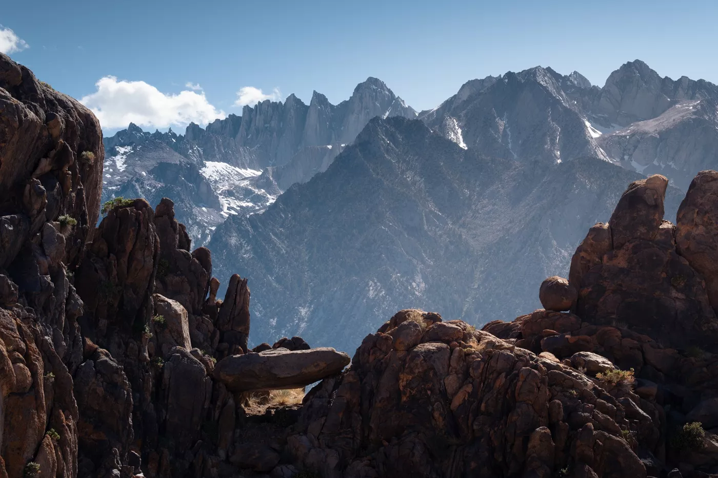
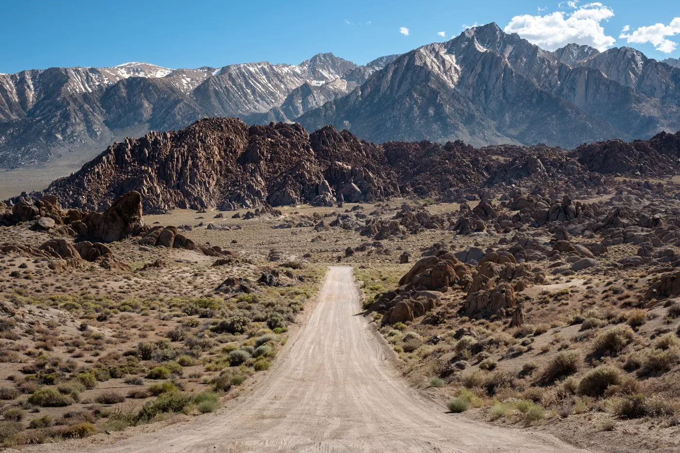
Sandwiched between the town and the Sierra Nevada mountains, these strange rock formations are amazing fun to drive through or hike around. They’re all a bit rogue and entertaining, with few designated routes – plus loads of films have used the Alabama Hills as a backdrop (like Django Unchained and Tremors!).
At a minimum, do the easy hike to Mobius Arch – it’s particularly striking and if you get the angles right, you can frame Mount Whitney in the arch!
Cottonwood Lakes (3+ hours)
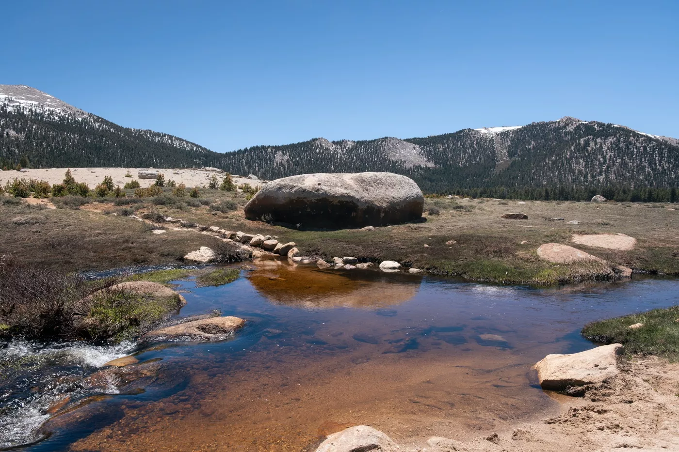
This area up in the mountains, around 35 minutes south of Lone Pine, is magnificent yet hardly anyone visits. Head for ‘Cottonwood Lakes Trailhead’.
It’s one of the main access points to the Pacific Crest Trail from Lone Pine, so you might meet a bunch of cool long-distance hikers and even be a hero by giving them a lift to town!
The paved, cliff-edge drive is insane, with vast views all the way across the salt flats towards Death Valley and, at the top, there are easy hikes in various directions into the mountains. It’s a great place to hike for an hour or two at ten thousand feet up in the High Sierras if you’re not vibing with crazy strenuous, outrageously big elevation changes.

Museum of Western Film History (1-2 hours)
This is a must-see stop if you’re a classic film enthusiast. Even if you’re not, there are so many epic signed retro posters, memorabilia and film paraphernalia that you won’t get bored! It’s not just older Western films either, there’s loads of information on newer sci-fi and fantasy genres as well (so your kids will probably love it, too).
Even the gift store (I usually avoid these) is a vibe with so much curious stuff!
We appreciated the effort that’s been put in here and the entire place has this sense of nostalgia. Definitely try to dedicate an hour or two if you can. Go before a visit to the Alabama Hills area then it’ll help you with the filming locations.
There’s an $8 entry donation per person.
Cottonwood Charcoal Kilns (30 minutes)
This could have been a cool stop to check out two pretty old but well-preserved kilns, but unfortunately they’re now hidden behind a bunch of metal fencing because I think people kept damaging them. There used to be a sign with some information but that’s mysteriously disappeared, too.
It’s also a pretty bumpy route in along an unpaved track, so don’t bother unless you’re in the area, have loads of extra time and are particularly keen.
I only took one photo and it’s not even worth putting on here.

Manzanar National Historic Site (2 hours)
Manzanar is one of ten infamous Japanese internment camps from the Second World War, complete with watchtower.
It is essential visiting when in the area to understand more about the injustices that up to ten thousand United States citizens of Japanese descent were subjected to due to some highly messed up, paranoid, racist policies. There are exhibits, a film, gardens, cemetery, barracks and more.
It’s worth a few hours of your time and makes sense to visit on the way to your next stop in Big Pine – check opening times and visiting information.

Hotels and Camping
The best place to stay in Lone Pine is, without a doubt, the Dow Villa Motel. It’s central, simple, but comfortable, and friendly. We’ve stayed here a handful of times now and would definitely return. This place sells out during busy seasons, so book ahead.
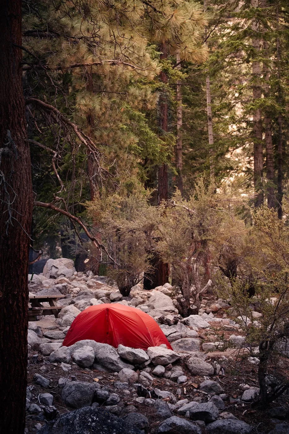
There are loads of incredible places to camp around Lone Pine, the two best being Whitney Portal Campground and Lone Pine Campground, mentioned above. Reserve spots in advance. There are also BLM opportunities in the Alabama Hills.
Food and Drink
Alabama Hills Café and Bakery: a super popular place with smashing breakfasts, including a few dedicated veggie options. I’m a big fan of the omelette for a chunky meal to start the day. And, if you need a surplus of calories after a long hike, this is the spot!
Tacos Los Hermanos: my friends rave about this place. It’s not super veggie friendly so I’ve not been there, but it’s so well regarded by people we know that we had to mention it! I know they will cater to veggie palettes if you ask, so go check them out!
Mt Whitney Restaurant: quirky décor but high prices, however they do a lot of veggie burger options which I’m grateful for.
Jakes Saloon: not my vibe (I never got the feeling that friendly vegan hipsters appear to be welcome there). We’d recommend it if you want a quick beverage with the saloon vibes, but unless you’re a straight white male, I’d probably give it a miss.
Lone Pine Market: the only supermarket in town, moderately stocked and frequented a lot by PCT hikers, but we found a lot of things to not have prices on.


Quick Stop: Independence
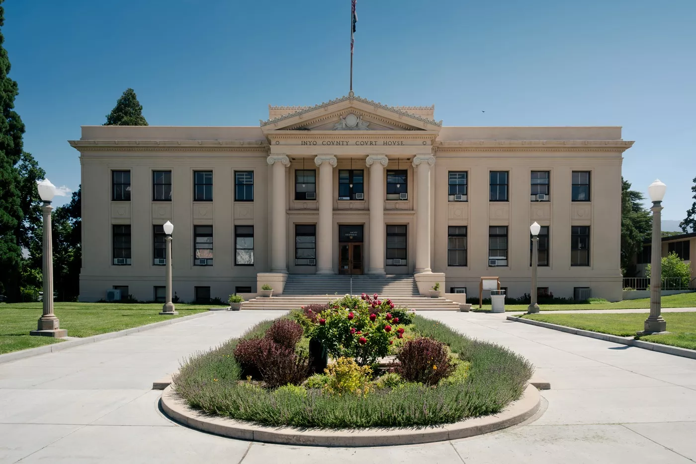
There’s not much reason to stop in Independence, but a lot of people take a quick break to check out the classical Inyo County Court House. It’s quite pretty and right on the main road, so you can’t miss it.
Also, a tiny diversion off the main road is the Eastern California Museum. It has a surprising number of indigenous historic and cultural artifacts, plus an actual train and lovely gardens. It’s particularly worth a visit if you go to Manzanar National Historic Site first.
If you’re in need of some sustenance, check these out:
Cowboy Coffee: quick, quirky stop for coffee with a friendly owner. I don’t drink coffee, but Nick loved it.
The Lemon Food Truck: probably the best Mexican I had along this entire route. They’re adaptable for veggie people and I love anywhere that will do me some chilaquiles!
_
Day 3: Big Pine
The town of Big Pine, around a 40-minute drive from Lone Pine, is pretty small and we’ve never spent an enormous amount of time in it.
The major highlights are either side of it, in the mountains.
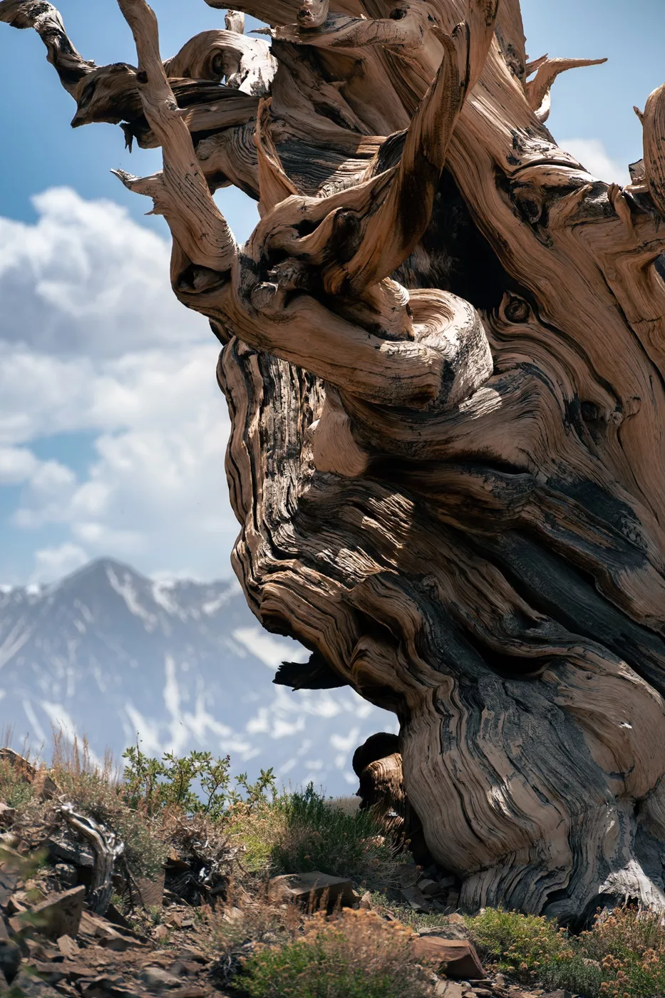
Ancient Bristlecones of the White Mountains (2+ hours)
The world’s oldest trees!
These gnarly survivors generally grow above ten thousand feet of elevation in specific weather conditions, and it turns out that a small section of the White Mountains is ideal for them to flourish!
There are several hikes at the Ancient Bristlecone Pine Forest and one is pretty short. If you’re not a hiker, take it slow because the elevation can seriously get to you. We’d recommend a couple of hours here, depending on how far you hike.
The drive up through the mountains is pretty spectacular, too.
Big Pine Lakes and the John Muir Wilderness (1 day)
One of the more spectacular hikes in the east Sierra Nevada Range.
This hike begins next to the lovely Big Pine Creek Campground and is a 10–15-mile hike (depending on your turn around point) with more than 3000 feet of elevation change, so it can be tricky if you’re not used to the thin air. This route passes by (up to) seven of the prettiest, brightest blue lakes you could imagine, with few crowds purely because it’s so difficult to reach.
I found the round-trip hike exhausting because I’m a sea-level dweller and definitely wished I’d backpacked and spent the night rather than day tripped. (I had a camping permit a few years ago but it was cancelled due to forest fires and, this time, I was too late to get one).
The permits sell out fast, so check in advance if you’d like to stay overnight (you need to select ‘Big Pine Creek North Fork’).

Hotels and Camping
We’ve never stayed overnight in Big Pine because we always camp in the local area. However, if we were to choose a motel, it would definitely be the Starlight Motel – the best in town.
As mentioned above, our favourite camp is Big Pine Creek Campground, a ten-mile drive to the west of Big Pine. We’ve camped there a few times and have never had a bad site. They’re large, well-spaced, and most are nearby streams or the creek, which means you have abundant water. Reserve a spot well in advance during high season.
Adjacent to Big Pine Creek are the Sage Flat Campgrounds, which are just as nice, but a little further down the road. It’s best to reserve in advance, but they’re a little less competitive than their more popular neighbour.
On the other side of Big Pine is Grandview Campground, near the Bristlecone Pines. It’s a basic campground with pit toilets and no water, but I really like it because the sites are spaced out and it’s always quiet. Be aware that it’s at about 8,500 feet elevation, so can get really cold at night, but is amazing for star gazing. No reservations, first-come, first-serve.
Food and Drink
Copper Top BBQ: we haven’t been here because, you know, it’s not particularly veggie friendly. However, it is extremely popular and well-known, so we’d recommend checking it out for lunch or dinner if BBQ is your jam!
Brewed Awakening: go purely for the pun! But, also, if you’re in need of a coffee or breakfast, the excellent offerings here (there’s even some veggie options – I had a smashing veggie bagel) are worth a stop. They do loads of plant-based milks, too, and even matcha!


Day 4: Bishop
Bishop, just 15 miles north of Big Pine, is a (relatively) large town, so has quite a lot of amenities, including a decent-sized Vons if you need to stock up on supplies and groceries. Outside of town, the main interests are the beautiful high-altitude lakes, many of which are easily accessible.
If you don’t want to take any long hikes, the lakes can be seen in an hour each. However, if you plan to do any water sports or longer hikes, schedule extra hours or even days.
Crowley Lake Stone Columns (2-3 hours)
These are some quirky stone columns along the edge of Crowley Lake.
They’re worth a trip if you have a four-wheel drive car with decent clearance. If not, you’ll have to walk an exposed 45 minutes-ish because the road is rough.
Personally, I don’t think it’s worth the walk. Also, be aware that the pillars are sometimes submerged when the water level is high, making them less visible. Unless you’ve got an enormous all-terrain monster, skip this and head to Hot Creek below.
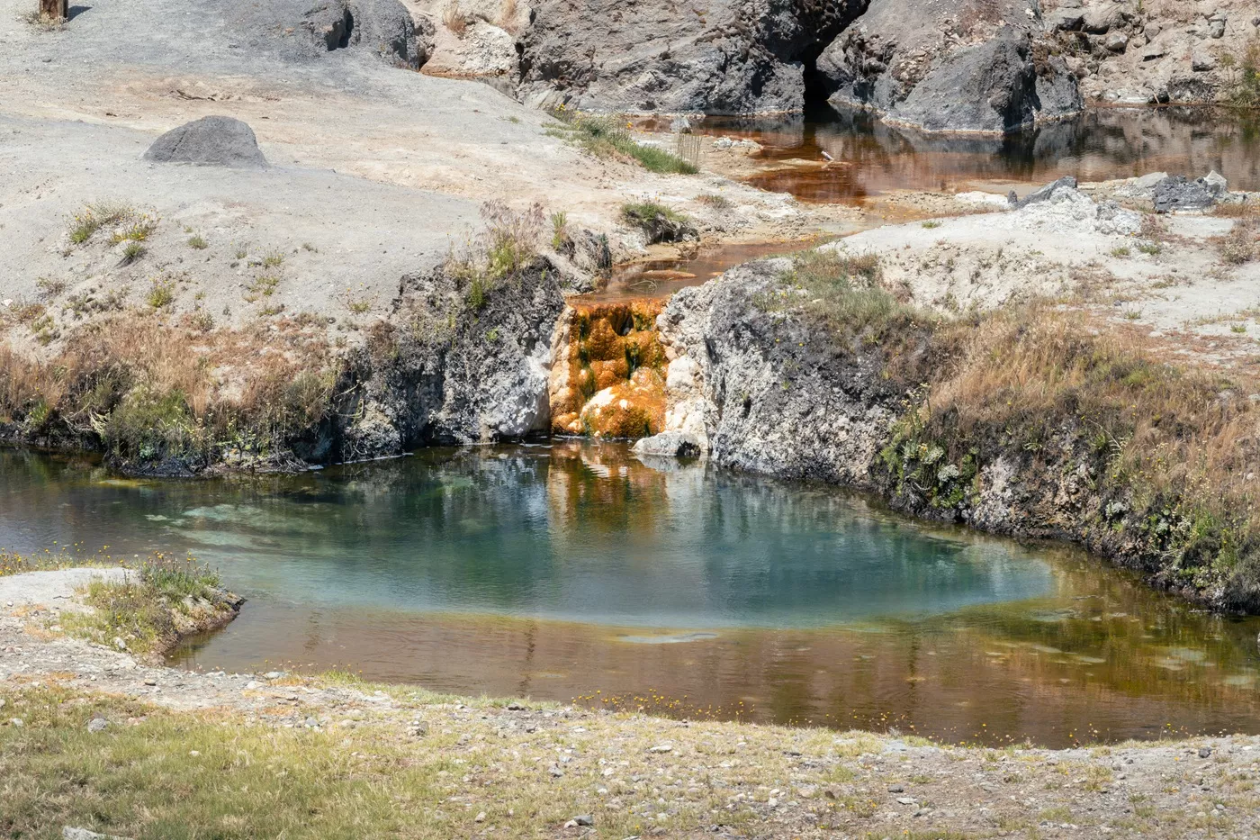
Hot Creek Geological Site (1+ hours)
This is a super pretty river valley packed with loads of geological, bubbly features, with the snowy Sierras as a backdrop.
You can walk around here and spend as little or as long as you want. There’s a small hill to descend to the bottom from the car park, but it’s not strenuous.
The road in is partly dirt, but really easy to drive with any vehicle.

Convict Lake (1+ hour)
This spot is perfect for anyone who wants to explore a super-scenic alpine lake without hiking strenuous routes or driving far! The water is surrounded by peaks and is really quite scenic.
Convict Lake has excellent parking, facilities and a nice campground, plus a mostly flat, three-mile trail that traverses the entire lake.
Be aware that this particular lake gets crazy busy on weekends in summer, and it’s full of the loud boat-bro types. We’d recommend avoiding it then.
Sabrina Lake (1+ hour)
This is probably my favourite easy-access spot in the area. It is so pretty, with snow-capped, soaring mountains surrounding a beautiful aquamarine lake. It kind of looks like it has an island in the middle, too, even though it doesn’t!
Parking is easy (although can be busy in peak season), there are reasonably easy trails for hikers, and it’s perfect for kayakers, too. The area is slightly less visited than Convict Lake, but not by much, so try and avoid weekends if you can’t arrive early.
South Lake (1+ hour)
This spot is perfect for serious hikers who want to head into the Sierra Nevada range and take a full day to explore.
It has loads of parking, the usual trailhead facilities, and provides easy access to the backcountry. South Lake, adjacent to the car park, is pretty but I prefer Sabrina Lake if you have to choose.


Hotels and Camping
There are quite a few motels in town – however, a lot of them very mediocre at best in our experience (especially the larger branded ones). Wayfinder Bishop is by far the best out of the places we’ve stayed, and we’d highly recommend that one if you can stretch your budget.
Food and Drink
There’s an abundance of reasonable food, drink, bars, and coffee places in Bishop. We could easily stay here a week and not get bored.
1903 Taphouse & Co: does a build-your-own vegan hotdog, veggie chilli, and mac ‘n’ cheese. It also does a billion other pretty great meaty American products, too, at surprisingly reasonable prices. As per the name, they also do a whole bunch of local crafty beers at decent prices, so pop in for a calorific value-for-money meal and beverage!
Mountain Rambler Brewery: this place has excellent beer and a tonne of veggie food options. If you’re a vegetarian, visit here if you want a casual pub meal where you’re more than just an afterthought! Also, visit for the quality, crafty, hazy IPAs that will put Budweiser to shame – order a flight.
Looney Bean: I’ve only had the breakfast burrito, chilaquiles, and coffee here, but it was, by far, the best value food I’d had in a while. Would highly recommend for an early morning visit (they open early, from 6am).
Erick Schat’s Bakkerÿ: this bakery and restaurant is crazy famous. Genuinely, the best bagels I’ve ever eaten in my life were from here (and I’ve had more than my fair share). I unashamedly ate an entire pack of garlic and cheese ones in the car park by accident. They also have smashing fresh cakes ( I have also eaten a load of these in a car park).
Whiskey Creek: a hundred-year-old establishment serving classic and Asian fare, including a surprising number of vegetarian options. It’s a bit saloon-style stuffy for me, but the food is well priced, portions are chonky and there’s something on the menu for everyone.

A Mosquito WARNING
During late spring into summer, the lakes in the mountains can be savage with mosquitos.
When the snow melts, the mosquitos hatch and form enormous black swarms in particular regions.
Mammoth, Yosemite, and other High Sierra lake spots can be horrendous. We’ve backpacked through Yosemite in late June and been absolutely destroyed by them. Even with multiple types of repellents and head nets, we still left with more than 300 bites between us (most of which were from just one day).
At one point, our tent was literally black because it was covered in the little nightmares!
So go prepared if you’re visiting during this time of year.
–
Day 5-7: Mammoth Lakes
Mammoth Lakes is a famous little ski resort town during the winter months (it’s a celebrity fave). This means it has wonderful, full-on ski lodge vibes all year around. However, we visit for the abundance of lakes, hiking, and camping opportunities. It’s a genuine outdoor utopia.
The town is sizable, so has supermarkets, restaurants, and shops, but it’s quite spread out, so actually isn’t as big as it initially seems.
Devil’s Postpile National Monument (2+ hours)
This is a wall of cool, hexagonal basalt columns (a bit like Giant’s Causeway in Northern Ireland).
They are down a fun, windy, narrow road just past Minaret Vista. The road is steep and narrow so there are often access restrictions, and you have to get a shuttle bus rather than self-drive ($8 fee applies for the shuttle bus). It would be a complete nightmare down there with loads of cars!
If you fancy an easy hike, don’t forget to check out Rainbow Falls while you’re there.

Minaret Vista (30 minutes)
This is a pretty viewpoint of the crazy striking sawtooth mountains just past the ski lift area in Mammoth, with some interpretative signs.
It’s worth a stop if you’re going to Devil’s Postpile as it’s right next to the entrance to the national monument. There are picnic benches, bathrooms and a reasonable amount of parking – perfect for a lunch or sunset picnic.
The vista is pretty high up (over nine thousand feet) so remember to take a coat! Also, spot the insane, weird, windswept trees. It’s a pretty good spot for stargazing, too.

The Mammoth Gondola (half a day)
If you want to pop to the top of Mammoth Mountain but are not a skier, there is a scenic gondola ride that operates throughout the year (apart from some maintenance dates).
It’s kind of expensive at $39 per person so I’ve never been up there, but it’s a popular thing to do in Mammoth.
Find out more on the official Mammoth Mountain page.
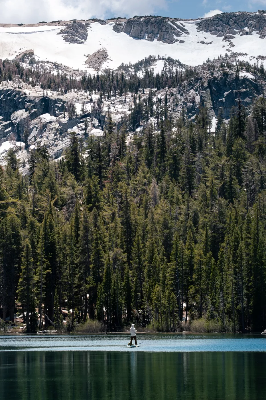
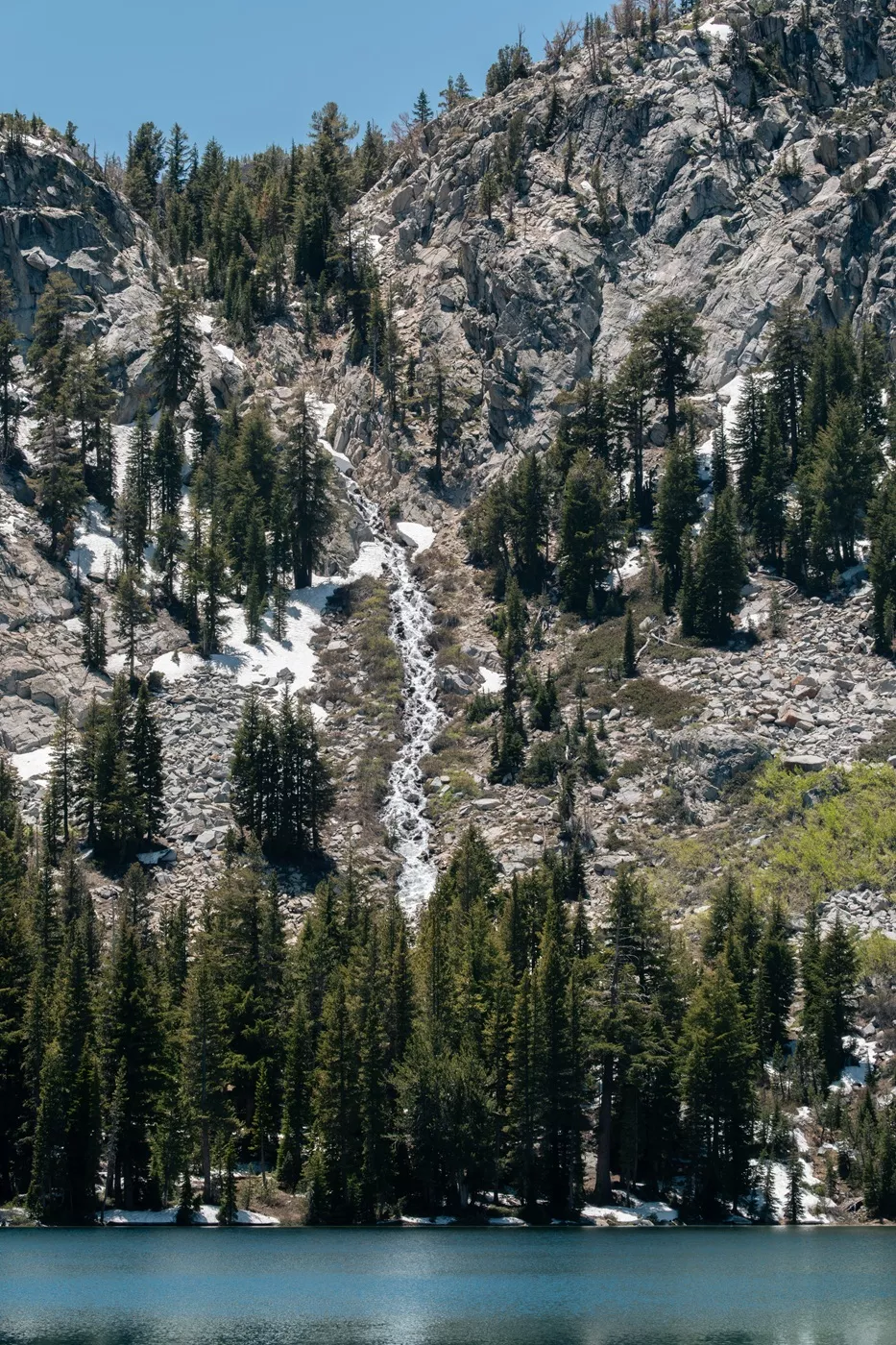
Mammoth’s Lakes (2+ hours)
Whether you’re a fisher, cyclist, kayaker, serious hiker or a backpacker, or simply looking for a casual wander, Mammoth’s crazy scenic lakes won’t disappoint.
For hiking, we’d recommend using the Alltrails app or/and the visitor center to choose what is best for your interests and fitness level. However, if you’re a keen hiker, hiking out to Duck Pass, past Barney Lake, is a personal favourite of mine in the area. It’s a bit steep but not awful, and the views are utterly magnificent. If you keep going, you’ll reach the legendary John Muir and Pacific Crest Trails!
Crystal Lake is a much shorter hike with panoramic lake views, and there are other numerous short, flat wanders around the various lakes. Nothing in this area will disappoint!
Hotels
We’ve stayed in a bunch of hotels and motels in Mammoth, and the one offering best for value for money was the Juniper Springs Resort. It had homely style apartments with kitchens, nice balconies, and secure underground parking so you don’t have to worry about bears breaking into your vehicle (it’s annoying having to empty your car at the end of each day, especially if you have loads of camping and cooking gear!).
We stayed in late spring/summer, so the rates were reasonable-ish compared with ski season.
If you’re going for the full, upper class ski lodge vibes, we’d recommend The Village Lodge Mammoth. I’ve never stayed there, but I wish I had – it looks magnificent.
We have stayed in a fair few branded and unbranded motels in Mammoth over the years and wouldn’t recommend a single one of them from a quality-to-cost ratio.
Camping
We’ve camped in Mammoth lots of times in various campgrounds, and our favourite is the one at Lake Mary. The sites are (relatively) spread out, the bathrooms are private and pristine, plus you can camp a few steps from the lake.
Controversially, my least favourite is the popular Twin Lakes Campground. It’s always packed, the sites are practically touching each other and there are only a few sites with good views.
Be aware that the various campgrounds open for the season on different dates! Check availability on Recreation.gov.
Food and Drink
Mammoth Brewing Company: we’ve spent a lot of time here, like most lunch or dinners when we’re not hiking. It has great craft beers (get a flight – some of them are really unique), a decent pub-grub menu with a few perfectly reasonable veggie choices (try the blackcurrant and goat cheese flatbread), plus a nice outdoor vibe with lots of doggies and some games.
Shelter Distilling: this spot is popular for cocktails and small plates. I don’t know about the food personally, but the drinks are on point.
Distant Brewing: my other favourite place in Mammoth. This place has the the most exceptional hoppy IPA beer choices in town, without question. Those hazy IPAs are dense! The food is decent with a few veggie options, too. This spot has a slightly nicer patio area than Mammoth Brewing, if you’re intending to sit outside on a sunny day.
OPTIONAL STOP: JUNE LAKE
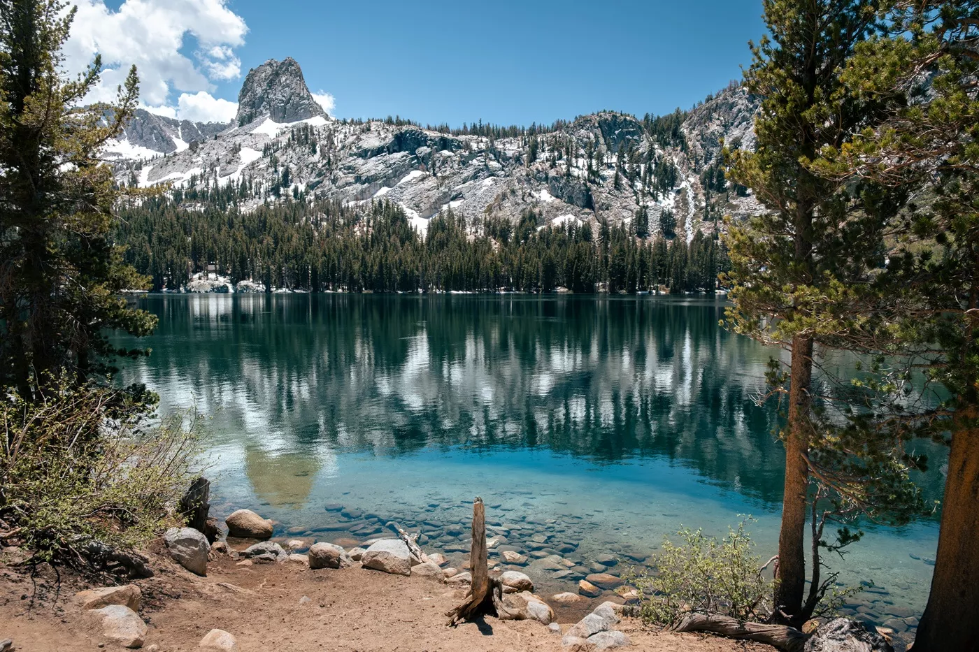
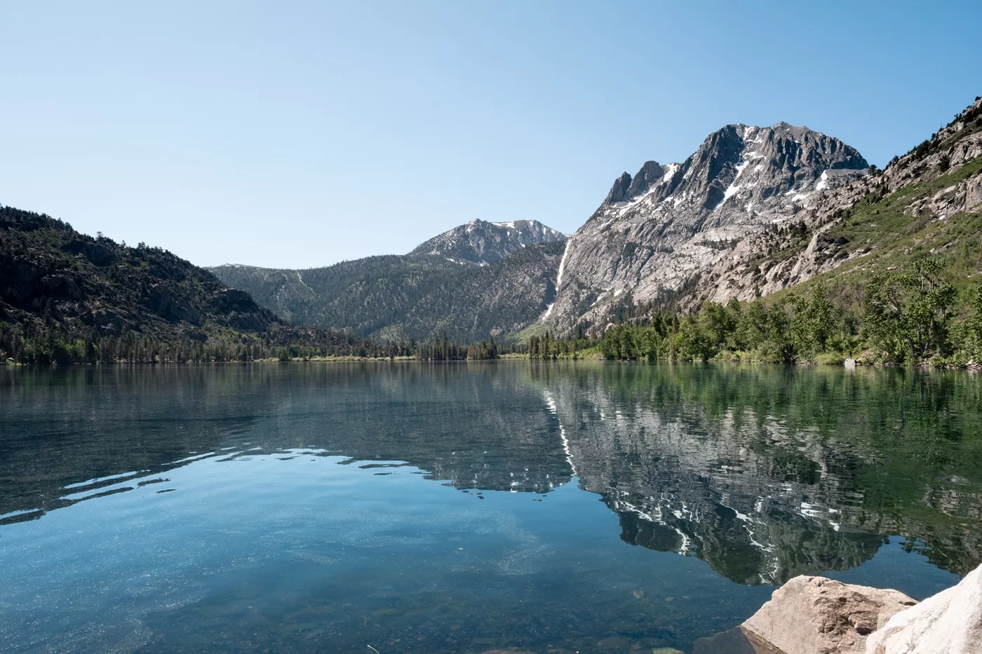
Whether you decide to spend the night or just pop in for the day, we’d recommend a quick jaunt around the loop next to June, Silver and Grant Lakes. There’s not tonnes to do, but it has a few excellent hikes, a nice brewery, and some cool camping.
The area is a decent base for an overnight stay to explore Mono Lake from, too.
Hike up the Gem Lake Trail for some epic High Sierra scenery, views of Horsetail Waterfall (which was flowing heavily even in mid-summer when we were last there) and minimal people (aim for the Ansel Adams Wilderness sign – you’ll probably be alone!).
Grab yourself some ice cream and pop into June Lake Brewing, with loads of decent crafty beer choices and outdoor seating.
Generally, we found parking around the June Lake area to be a bit exhausting, so call ahead for anywhere you really want to visit and check your accommodation includes parking.
–

Passing through: Mono Lake (1+ hour)
Mono Lake is a weird, oasis-like body of mineral-dense water. This strange, otherworldly environment is heavy on salt and sodium bicarbonate, and is 2.5 times saltier than the ocean.
The lake is known for its ‘tufas’, these alien-looking limestone towers that dot the edges of the lake, and are described as ‘petrified springs’. They originated underwater, and are formed from calcium carbonate deposits that originate from the lake bottom. There are also markers showing the depth of the water at various times in history, and you’ll see lots of bugs and birds. It’s worth at least a quick visit!
The simplest place to access the tufas is at the South Tufa Interpretive Trail, which has easy parking, bathrooms and a flat one-mile boardwalk that leads you around the lake shore.
Adjacent to this hike is the Panum Crater. It’s a rhyolitic plug-dome volcano and worth a hike up, if you have time, for views of the lake and lots of obsidian rock. Be aware that the road is rough – doable with a high-clearance vehicle and a little bit of patience, though!

Day 8-10:Yosemite (optional)
Yosemite is a highlight for most visitors to the High Sierras. It’s one of the United States’ most popular national parks and an obvious choice for anyone driving the Highway 395 route.
However, access it is usually only from the eastern Sierras during late spring, summer, and fall. Access depends on the snowfall each year along the access road, called the Tioga Pass (marked as a red cross on my map at the top).
If the pass is not open, it’s a huge, more than 6-hour, 276 mile diversion each way (instead of a 75-mile, two-hour drive) that is not really feasible for this itinerary.
If Yosemite is on your must-see list, either visit from late spring/summer onward, or drive a loop around the Sierra Nevada Mountains (via State Route 88) and see Yosemite from the other side at the end of your trip (plus you can pop into Sequoia and Kings Canyon National Parks, too!).
How to Spend 2-3 Days in Yosemite
Although unbearably crammed with people, Yosemite is one of our favourite parks in the United States. It’s spectacular and has some of the most challenging, yet accessible, hiking within some of the most outrageous mountain scenery.
If you decide to visit, here’s a quick list of things we recommend:
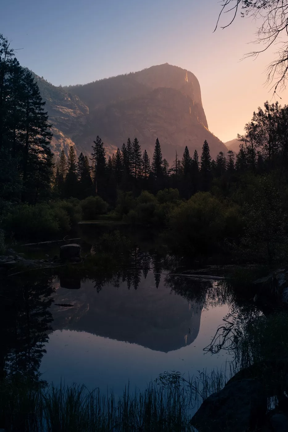
⬩ Mirror Lake: easy two-mile round-trip hike within the valley (watch out for mosquitos).
⬩ Glacier Point: at the end of an easy, scenic drive with accessible and spectacular viewpoints. Hike to nearby Taft Point and Sentinel Dome for some extra magnificent views. We were growled at by a bear up there, twice; I nearly shat myself.
⬩ Vernal and Nevada Falls: probably Yosemite’s most famous hike. Two roaring waterfalls (depending on the time of year – mid/late spring is best), with several routes up and down – the John Muir Trail and the Mist Trail. It’s reasonably challenging but, taking it slow, most mobile people can do it (I find the John Muir Trail option easier and less anxiety provoking).
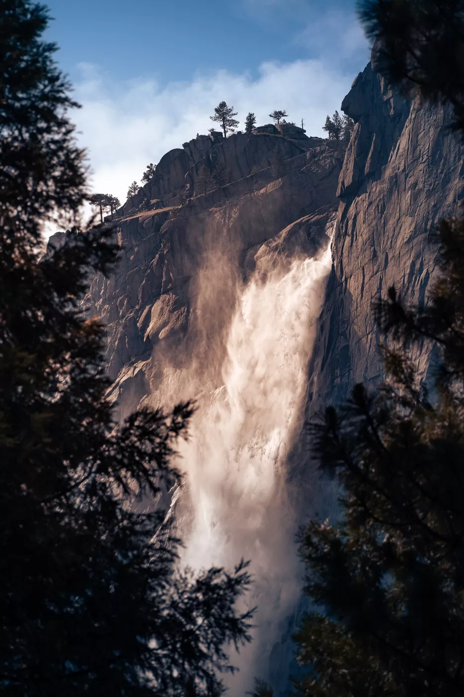
⬩ Yosemite Falls: this hellishly steep, but popular trail leads up to the top of Yosemite Falls, with magnificent views of the valley. For nicer views and far fewer people, I prefer the steep-as-all-hell Four-Mile Trail which has incredible vistas across the valley directly to Yosemite Falls! There are fewer crowds and the views are unbeatable.
⬩ A few of our favourite views for people who cannot hike far: Glacier Point, Lower Yosemite Falls, Cathedral Beach, Tunnel View, Bridalveil Falls, Hetch Hetchy, Tuolumne Meadows and Tenaya Lake. The Yosemite Valley Loop is also a great walking option for non-hikers because it’s flat and there are shuttle buses that run alongside the walk so you can be flexible with how far you walk.
Short on Time?
Assuming the Tioga Pass is open for your trip, you can always visit the High Sierra section of Yosemite National Park nearest to Highway 395 (not the valley).
From the tiny town of Lee Vining, it’s just a scenic 45-minute drive to Olmsted Point, where you can see clear views of Half Dome and Clouds Rest. On the way is Tenaya Lake and Tuolumne Meadows, with options for some epic hiking if you have time (consider day hiking to Cathedral Lakes, Sunrise Lakes or even Cloud’s Rest if you’re fit as a fiddle). It’s an incredible area of the park and far fewer people visit here than the valley.
Note: The 45-minute driving time assumes no significant queueing at the Yosemite Entrance.
Spending a night in June Lake is an ideal option for this.
Quick Guide to Sleeping in Yosemite
Accommodation in Yosemite Valley sells out fast and is genuinely horrible value for money. We’ve stayed in almost every option, within and outside the park, and the below are our (very blunt) thoughts:
Lodging Outside the Park
When not camping, we tend to opt for lodging just outside the park at either Cedar Lodge or Yosemite View Lodge. Both are still overpriced, average motel-style accommodations, but you can get to the entrance pretty quickly and they are slightly better value.
There are other, higher quality accommodation options in Oakhurst and Mariposa. However, these are a fair distance outside the park, but have nice restaurants and offer slightly better value for money. In Oakhurst, we always opt for the Best Western Plus Yosemite Gateway Inn, and in Mariposa, the Best Western Plus Yosemite Way Station is best. For a slightly more affordable option, try the Mariposa Lodge.
We’ve stayed in all of them a few times and prefer Mariposa just because it has less of a ‘big town feel’ and is also a little more affordable.
Lodging in the Park
Hotels within the park boundaries are outrageous and horrible value. People opt for them because of their location, but I haven’t really liked a single one, despite the benefit. The Ahwanee is the nicest, but you may have to remortgage your house to stay there! They also sell out really quickly, so check early for options and crack out your credit cards.
If you’re looking for some kind of hybrid hotel-camping option then Curry Village within the park is in a fantastic location and has big pre-fab tents with beds. These are great if you like camping, but still okay to spend $$$. There is also Housekeeping Camp, which is a selection of open air huts with beds (bring your sleeping bag), which are crazy overpriced, in my opinion, but works out a little cheaper.
Camping in Yosemite
Trying to reserve camping in Yosemite will be the death of me, I’m sure of it.
Camping in the valley is particularly tricky because it’s outrageously in demand, often selling out in literal seconds.
If you’re choosing a campground, Lower Pines is my least favourite campground – it’s basically just screaming kids, bros partying all day and ignorant campers leaving food out for the bears. The others are a bit less chaotic. Just don’t camp in Yosemite Valley expecting any kind of chill vibes.
QUICK ALTERNATIVE TO YOSEMITE: SADDLEBAG LAKE
If you don’t have time or simply can’t deal with the crowds of Yosemite, but want some of those High Sierra vibes, consider popping into Saddlebag Lake. It’s just off the Tioga Road heading into the national park (you don’t need an American the Beautiful or national park pass, though). There are some seriously excellent hikes in the area, beautiful lakes, and camping options too.
Be aware that it’s at a very high elevation (around ten thousand feet), so check weather conditions and remember to pack three-season camping gear. Also, the road isn’t completely paved, but fine for a normal vehicle.
–
On the way: Bodie State Historic Park (3 hours)
A 45-minute drive north from Mono Lake is Bodie. It’s a preserved (but not renovated) gold-mining ghost town from the mid-late 1800s, which reached a population of around 7000 at its peak. It was apparently the sixth largest town in California at the time!
It’s pretty large, as ghost towns go, and definitely worth a visit if you want to see loads of quirky old furnishings, household items and machinery all covered in a thick layer of dust (okay, this makes it sound less exciting, but I promise it actually is great and the best ghost town I’ve visited). You’re even allowed into some of the buildings, too, which is even cooler.
I particularly liked it here because it didn’t feel tacky, kitschy or dramatic for the sake of visitors like some other ghost towns (at Calico, for example). It’s basically what the town looked like, with the store, houses, church, saloon, and hotel all left exactly as they originally were.
Three miles of the road to the park is unpaved, but it’s not particularly rough. We had a high clearance car but saw a bunch of standard sedans in the car lot, so unless you’re driving something crazy low clearance, I think you’ll be fine on the roads. There are a few routes to the town, so ensure to take SR270.
Bodie has been a state park since 1962, so there’s an $8 per person fee. Take the stamp mill tour if you’re there at the right time ($6, twice a day seasonally between May and October), and buy a self-guided walking tour booklet ($3).


Days 11-14: Lake Tahoe
Lake Tahoe is the final (or first) stop on this highway 395 itinerary. It’s an enormous, high-altitude lake (the third deepest in the United States, at 1600 feet) that straddles the border between California and Nevada.
The water is insanely clear, meaning you can see more than 50 feet down. It’s really beautiful.
The lake’s elevation (above 6000 feet) means it’s a popular spot in summer, with comfortable, warm weather that’s perfect for water sports like kayaking and boating. In the winter, the ring of mountains surrounding the lake provide epic winter sport opportunities, with famous ski resorts providing access to the peaks.
We mostly go to Tahoe to hang out. It’s got a fun, outdoorsy vibe and I just love the surrounding scenery. Below are a few places we’d recommend you include on your trip.

Emerald Bay State Park
This is a cobalt blue, semi-enclosed bay with a small rocky island, perfect for kayaking and boating.
Be aware it’s crazy hard to park here – there are so few spaces and cars line both sides of the road. The main car park charges $10 per day (Tahoe is such a rarity on this trip for parking fees). Arrive really early.
It’s a steep hike down to the bottom but worth it for the views. There are kayak rentals ($40 an hour) and you can swim.
While you’re parked there, take the short hike to Eagle Falls, and head onto Eagle Lake if you’re keen (it’s not far, but a bit steep). Trying to park at the designated lot haunts my nightmares.
Heavenly Gondola
This one is pricey, so I’ve never been up, but the Heavenly ski resort Gondola in South Lake Tahoe is popular even in summer for vast lake views and activities on the top of the mountains.
It is crazy expensive, but take a look if you think it might be your sort of thing.
The Casinos
Again, this isn’t something I’ve done much of in Tahoe (why would you when Reno and Vegas exist?) but loads of people come to Tahoe to gamble!
The obscenely large casinos just on the Nevada border look a little out of place but are a perfect evening if that’s your cup of tea.
Tahoe’s Beaches
Lake Tahoe has a lot of beaches. Like, a lot.
Despite the abundance, they still get absolutely rammed (even the ones you have to hike to!).
I think that Secret Cove and Whale Beach (and others in that area) are some of the prettiest. (The water really is as blue as they say, and the people are also sometimes as naked as they say). I’d recommend exploring the entire north-eastern coast of Lake Tahoe – the crystal-clear blue waters and perfectly smooth round rocks are magic.
In that same area, I actually love Sand Harbor State Park – it has the prettiest water in my opinion ($15 entry).
There are a few crazy spots where you must pay exorbitant prices – like Lakeside Beach, which costs $30 just to get in during the high season. Personally I’d just avoid that entirely unless you’re loaded – it’s crazy.
The entire of South Lake Tahoe is lined with wide-ish strips of sand, so if you pick a hotel in the area, it’s possible you’ll be able to walk to a beach (loads of sections don’t have public access though, in my experience).
Nevada Beach is probably the best one that we’ve been to for easy access and proximity to town. It’s perfect for kids and has $12 parking.
Pope Beach is nice, I like the trees ($12 parking). Baldwin Beach is another nice spot where we’ve actually managed to get parking during peak season ($12 parking).

Where to Sleep
We have always used South Lake Tahoe as a base for the area as it has the most hotels, restaurants, fun and vibes (we usually come to Tahoe to chill after some form of horrendous, torturous hiking and camping). However, you could easily stay in the north, where it’s quieter, in Incline Village or around (there’s accommodation options all around the lake.
There are so many options in South Lake Tahoe, but we choose to stay in Basecamp Tahoe South. It’s the most affordable of the options where we can walk to various spots and also park easily. The rooms are simple but quite comfy and South of North Brewing Co. is attached to the building (would highly recommend a visit for evening fire pit vibes).
Most of the mid-range motels we’ve stayed at in the past have been shockingly bad value for money.
Camping
There are campgrounds dotted all around the edge of Lake Tahoe, however they are always busy in summer and too cold to frequent in winter.
Our favourite campground is in Sugar Pine Point State Park. It’s nice and I love that you can walk to the beach, but the campsites are tucked away in the woods.
Food and Drink
Blue Dog Pizza: I know Base Camp Pizza Co. is more popular but, possibly controversially, I think Blue Dog does better pizza. Base Camp has more space and is in a more comfy setting, so if you want a nice sit down vibe, choose them (be prepared to queue!). If you want something more casual, check out Blue Dog! They have two locations – I prefer the midtown one.
South of North Brewing Co.: as I mentioned above, this little place has fantastic crafty beers, decent pub-grub food, a lovely setting in the trees and loads of outdoor space. They put on live music in the evenings and there is no place I’d rather be sat at in Tahoe.
Sprouts Cafe: I love Sprouts. After a few days of eating too much pizza, I come here. They have smashing veggie options and a generally nourishing and colourful food that always makes me feel better. It has a lovely little patio and served great smoothies and fresh juices.
South Lake Brewing Co.: this minimalist spot has some of the best beer in town, by far. Beer flights, giant salty pretzels and a lovely patio. What more could you want after an active day?
OPTIONAL: RENO
Reno is like a more affordable, elderly Las Vegas. I know people might disagree here, but it’s just got that feel to me. I like Reno because it has stuff, but at a price point I can afford.
If you’re not here to gamble, we’d recommend you dedicate your time elsewhere. We don’t gamble really, but do love comfy beds and straightforward hotels.
Apart from gambling, the city has a few museums, like the National Automobile Museum, Nevada Museum of Art and The Discovery, which are great if you’re a museum fan or it’s summer and boiling hot.
Our most recent find was 10 Torr Distilling and Brewing, which had magnificent beers, nice vibes and we’ll definitely return the next time we’re in town.
Our two favourite spots to sleep recently were the Best Western Plus Sparks-Reno Hotel, which is your typically basic, but decent motel option a little out of town, and the Grand Sierra Resort and Casino, which is a glitzy casino-style option with lovely views of the surrounding mountains.
–

CAR HIRE FOR YOUR CALIFORNIA TRIP
We always rent our vehicles all over the world, including our recent trips in the United States, Mexico, Thailand, Japan, Malaysia, Oman, Saudi Arabia, Tunisia, Jordan and Morocco, with Discover Cars. They’re often the most affordable, plus they paid out immediately on an insurance claim we made when our car took some heavy damage in Sicily.
Find out more about why we love them so much!
–
TAKE A LOOK BELOW OR CHECK CAR RENTAL
Highway 395 Google Map
Below is a savable Google Map of all the spots we’ve talked about above.
To save this map, select the star next to the title.
Other Options at the End
This is a quick list of awesome things that we’ve loved that can be added to the end of your highway 395 trip (driving distances from Tahoe):
⬩ Lassen Volcanic National Park (3 hours)
⬩ Mount Shasta (4 hours)
⬩ Lava Beds National Monument (4 hours)
⬩ Crater Lake National Park (5.5 hours)
⬩ San Fransisco (3.5 hours)
⬩ Napa Valley (3 hours)
⬩ Yosemite National Park, if the Tioga Pass is closed (4 hours)
⬩ Sequoia National Park (6 hours)


Best Time to Visit Highway 395
The seasons are complicated and fickle in this area of California.
Summer (roughly July-August) is, objectively, the best time to drive Highway 395 when the higher altitude lakes are clear of snow and all the roads are open. However, this is the busiest and most expensive time too, plus the lowlands, like Lone Pine, are flaming hot. You’ll also have to book all your camping and accommodation choices well ahead of time.
Spring (April-June) can be fantastic, but you are relying on the weather to play ball and the roads and trails to be clear of snow (these dates vary wildly year on year). Backpacking at this time of year can be hit-or-miss, and the trails can be snowy or full of mosquitos if the snow is melting. The waterfalls are rushing at this time of year though, which is a huge win, but the water is freezing!
Autumn (Sep-Nov) can be the perfect time, but the wildfire risk is highest and we’ve had entire trips basically cancelled due to extreme fires. These occur and spread extremely quickly, so you’ll never know in advance if something was to happen. The weather is great though, and the school vacation period is finished so crowds are lower.
Winter (Dec-Mar) is only great if you’re into skiing rather than hiking! Otherwise, you’ll miss a lot of what is on this itinerary. Be aware that you will likely need chains for your car (and most rental companies don’t allow them).

HAS OUR FREE CONTENT HELPED YOU PLAN YOUR CALIFORNIA TRIP?
If you’ve found our content helpful, consider booking your rental car (if you need one!), through the company we always use – Discover Cars. They’re the absolute best and have been our rental companion (and savior, thanks to their insurance) in many destinations across the world.
Also, consider booking your accommodation through Booking.com – we use them exclusively when travelling in the North America.
Alternatively, leave us a tip to say thank you.
Help like this makes it easier to pay for the upkeep of this site and ensures our small business survives the onslaught of AI!
Help like this makes it easier to pay for the upkeep of this site. Thank you!
–
Where to Next?
While writing this post, I had mad cravings to re-do this entire trip. I still find the whole area crazy captivating and feel drawn back, time and time again. It’s not just a super photogenic region of the world, but also a perfect location for a meandering road trip through epic lakes and towering peaks.
If you’re thinking of doing a longer drive, take a peek through our longer California road trip itinerary, which takes you on a loop around the entire Golden State.
Also consider pairing your California adventure with more of the southwest – take a look at our southern Utah road trip which covers way more than just the national parks.
Have a great trip!
Hi, thanks for visiting our blog! If our free content has been of help to you, or you’ve just enjoyed our random ramblings and musings, say thank you by buying us a coffee! It helps keep The Restless Beans blog up and running.
Thank you, Claire + Nick


