

· MIDDLE EAST · OMAN ·
Jebel Akhdar: How Many Days You Need (and What to Do With Them)
Scribbled by Claire ⬩ 12 Aug 2026
Planning to visit Jebel Akhdar but are unsure of how long to stay, what there is to do, car requirements, or road conditions? If so, we’ve got you covered with absolutely everything you need to know.
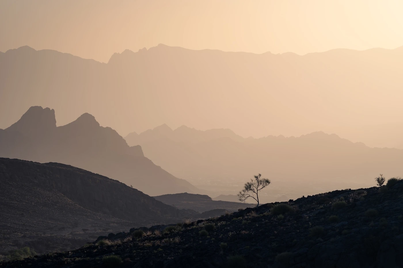
Jebel Akhdar, known as the ‘Green Mountain’ in Oman’s dramatic Hajar Mountain range, isn’t really a mountain at all.
In fact, the name ‘Jebel Akhdar’ is a misnomer; it’s actually an entire 2000-metre-high mesa called the Saiq Plateau, consisting of dozens of villages, a large town, loads of official hiking trails, and many miles of paved roads. It’s an entire region chock-full of things to see and do.
There’s hardly any decent information out there about Jebel Akhdar. I mean, that’s the reason I didn’t head up the to the plateau on my first visit to Oman, because nothing I read inspired me to go (plus I thought it was just a peak, like Jebel Shams).
However, on our second trip, we thought we may as well check it out and headed up without any expectations. We’ve been several more times since; it turned out to be an outrageously beautiful, mountainous area that’s well-worth a day or two of your time.
Here, we’ve written about how long you’ll realistically need (depending on your interests), lots of things to do beyond the main handful of attractions that everyone visits, where we’ve stayed, the best viewpoints, and all the logistics including the drive up.
IN THIS GUIDE //
Exploring Oman’s Most Popular Mountain
What is so Interesting About Jebel Akhdar?
– Mountain Climate
– Roads and Views
– More Reasons to Visit
Getting to Jebel Akhdar
– Between Jebel Shams and Jebel Akhdar
– Do You Need a Four-wheel Drive Car?
– About the Jebel Akhdar ROP Checkpoint
– What to Do if You Don’t have a 4WD
– Is the Road Difficult to Drive?
Best Time to Visit
Things to do in Jebel Akhdar and the Plateau
How Long to Spend in Jebel Akhdar
– In One Day/Overnight
– In Two Days
– As a Day Trip From Muscat or Nizwa
Where to Stay
– Camping
What Should You Wear?
Facilities
Where to Next?
This post may contain affiliate links. If you book through these links we may make a small commission at zero cost to you. It helps us pay for the upkeep of this blog. Thank you!
What is so Interesting About Jebel Akhdar?
Jebel Akhdar and the Saiq/Sayq Plateau are quite unique in Oman.
They’re part of the beautiful Hajar Mountain range that runs right across northern Oman into the eastern side of the UAE.
This range is rugged, harsh, and dramatic, no matter which part you visit, but a trip to Jebel Akhdar gives you access to some of the more improbable spectacles. It’s a rare sight: crop terraces, orchard trees, and general greenery that’s explicitly absent in other parts of the mountains.
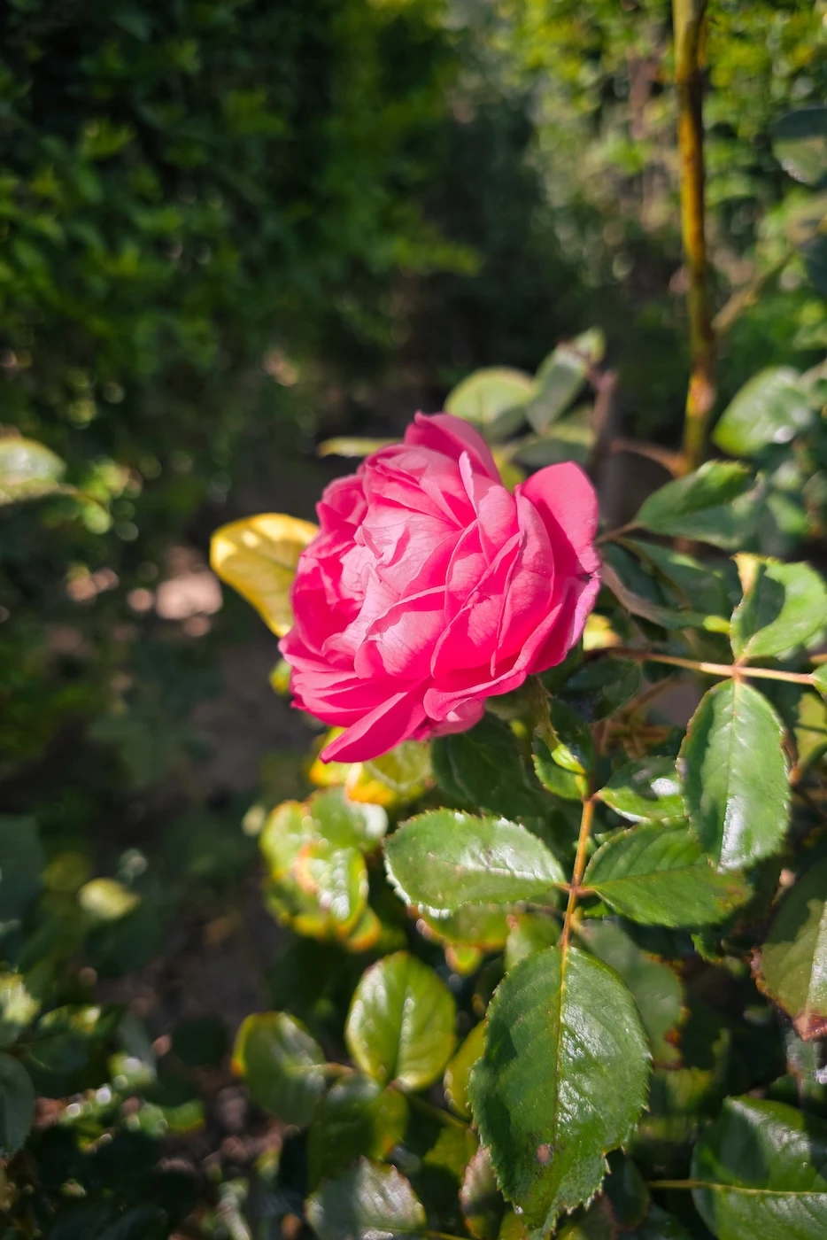
This region is utilised for agriculture due to its Mediterranean(ish) weather which brings far more rain to the Saiq Plateau than other parts of the country. So, thanks to the climate, you’ll see apples, apricots, pomegranates, figs, almonds, walnuts, and even roses. It’s estimated that the region receives around 3-4 times the average rainfall of Oman, which is conveniently spread quite evenly throughout the year.
Historically, the ability to cultivate crops led to a whole slew of tiny settlements spread out across the plateau, some now abandoned and others still thriving via farming and, more recently, tourism.
Mountain Climate
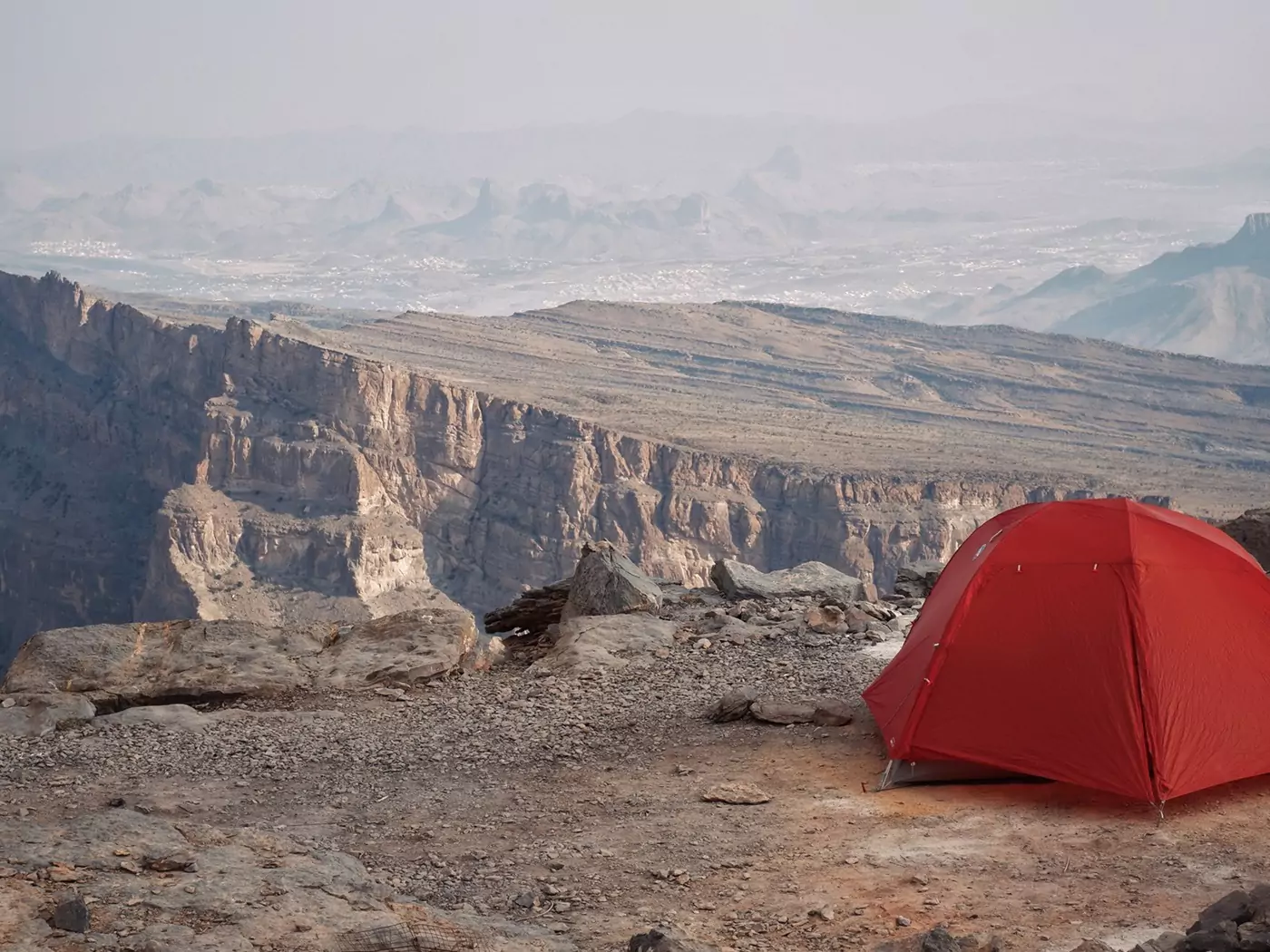
The elevation, around 2000 metres above sea-level and Oman’s lowlands, means Jebel Akhdar experiences far more in the way of temperate weather. While Oman bakes in the summer, the plateau see temperatures 10-15 degrees C lower and, in the winter, you can even wake up with ice on your tent (ask me how I know)!
This brings in loads of domestic tourism during the warmer months as residents escape to the mountains for a bit of respite from the continual sensation of being baked in an oven (Oman’s summers are hard).
Roads and Views
Another appeal of the Jebel Akhdar region is that, since 2006, a quality, multi-lane paved road has led visitors up to the high-altitude plateau. This means it’s easier than ever to see the incredible views and many beautiful villages (far easier than traversing neighbouring Wadi Bani Awf, for example).
Previously, the region was only accessible by an insanely steep, multi-hour hike that many residents undertook with the help of some seriously hardy donkeys. Princess Diana and then Prince Charles famously visited the region in 1986 and arrived by helicopter.
Now, you can just get a decent car and drive up in 40-minutes, allowing straightforward access to an incredibly scenic area that was otherwise almost impossible to reach by the average tourist.
More Reasons to Visit
⬩ It’s only around a 2.25-hour, 180-kilometre drive from Oman’s capital city, Muscat.
⬩ Jebel Akhdar is rural and isolated, but with an incredible array of quality accommodation that’s not found in other remote regions in Oman.
⬩ You’ll find lot of official hiking routes, so it’s perfect for the outdoorsy types.
⬩ There’s a bunch of lovely off-tarmac routes for the more car-oriented peeps.
⬩ Throughout the area are more than 30 villages to explore.
⬩ It’s easier to traverse than other mountain routes in the Hajar Mountains.
⬩ Wild camping is legal, encouraged and, most importantly, temperate for most of the year!
⬩ It’s nearby the cultural heart of Oman, the city of Nizwa, so a visit to both is easy to plan.
We’ve always found the best car rental prices for Oman on DiscoverCars. It’s our go-to car comparison website for every road trip because they have such good insurance. You can save loads of money and get great-priced comprehensive coverage.
Getting to Jebel Akhdar
The nearest obvious cities to Jebel Akhdar are Nizwa and Muscat.
Driving from Nizwa: it’s around 60 kilometres to Saiq from Nizwa, which takes 1 hour and 10 minutes to drive. The route is very straightforward, heading east out of the city until you reach Birkat Al Mauz Road which leads up to the plateau.
Driving from Muscat: the journey is about 170 kilometres, which takes about 2 hours and 20 minutes (depending on your starting point – Muscat is a very long city). The drive, once again, is simple, following the 15 south until Izki, where you follow signs to Birkat Al Mouz and then take a right turn up the mountain.
Both routes are entirely paved.
Between Jebel Shams and Jebel Akhdar
Some people plan to visit both Jebel Shams and Jebel Akhdar on their trip in Oman. They’re in the same part of the Hajar Mountain range, so it’s completely possible to drive from one to the other.
The journey between both is easy and takes around 3 hours and is 150 kilometres.
Unlike Jebel Akhdar, the drive to Jebel Shams is partially unpaved, but okay for a standard car because it’s not particularly steep (having said that, I wouldn’t be taking a Kia Picanto up there).
Tip: I don’t think you can properly see both spots in one day (the drives are just too long and you wouldn’t be able to actually do anything at either place). The best option is to stay somewhere like Nizwa, Misfat Al Abriyeen, or Al Hamra, which sit between both mountains and can act as a kind of hub. Then you can drive up one on the first day, then head to the other on the next.
Alternatively, camp or book a hotel on the summit of Jebel Shams, then book one on Jebel Akhdar.

Do You Need a Four-Wheel Drive Car to Access Jebel Akhdar?
Interestingly, yes.
It is absolutely mandatory to have a four-wheel drive vehicle (4WD) to access the mountain plateau. This is enforced by a very official police checkpoint that blocks the road leading up.
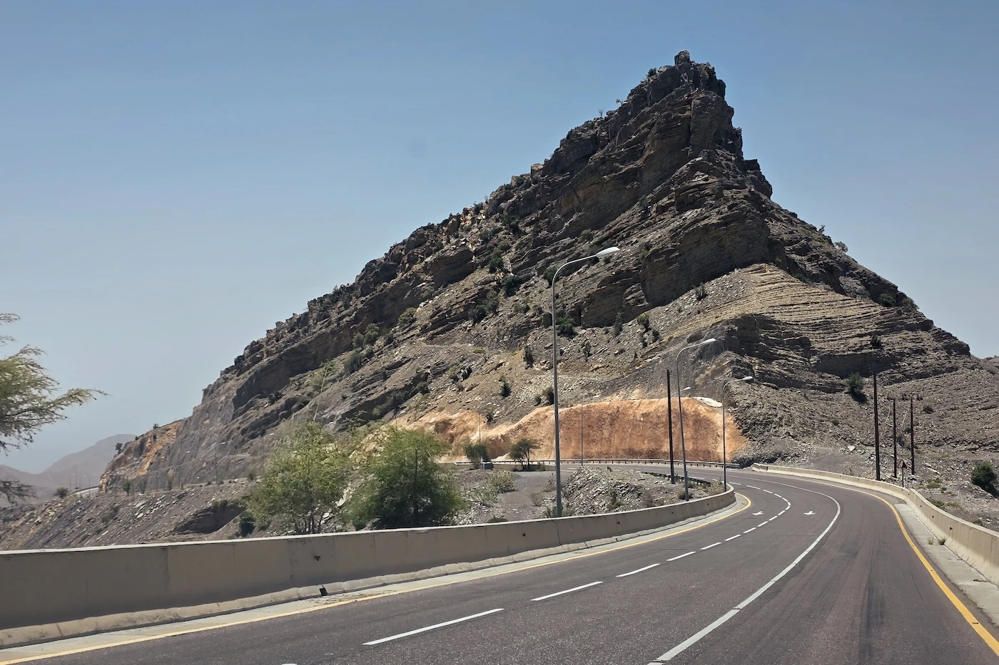
The reasons for the checkpoint have never been clear to me: the road is perfectly paved and easy to drive. However, it is quite steep and twisty, but far less than most of the other, far sketchier, roads through Oman’s mountains (none of which have checkpoints). It’s also got nothing on some of the roads I’ve driven in places like the Alps, Sicily, Morocco, or even tiny sections of the Lake District in Northern England.
However, the road rises 1700 metres in 30 kilometres and the Royal Omani Police (ROP) absolutely maintain that it’s dangerous when wet or in cloudy conditions, so be aware of the potential risks. I’ve been lucky and only driven it in clear, dry conditions so it’s always been a piece of cake.
About the Jebel Akhdar ROP Checkpoint
The checkpoint is located at ‘Jabel Akhdar Police Check Point’ on Google Maps. You can see the big building on Google Satellite.
At the checkpoint, a uniformed dude with a clipboard will look at your car, write down some details, and request some documentation.
We have only ever been asked to show a driver’s license each time we’ve been through here (possibly because we are obviously foreigners in a rental vehicle).
However, some people mention needing the vehicle insurance document (like a small credit card you’ll find in the glove compartment of your rental, usually) and also passport, but we’ve never had to do this.
The police count how many people are in your car, too, and there are reports that if your car is too full, they’ll refuse you access. I think the number of people will depend on the size/power of the car, but the limit seems to be 6-7 people per vehicle.
What to do if you don’t have a 4WD?
If you don’t have a suitable vehicle, you can leave your car at the bottom and get a driver to take you up (don’t worry, your car will be fine until your return – Oman is super safe).
There are parking spaces and drivers on the side of the road next to the checkpoint, but these are often full when we’ve passed by. The other option is to arrange for a driver just south of Bait Ar Ridaydah in Birkat Al Mouz, at the beginning of the road up the mountain. There’s a car park where drivers hang out and lifts can be arranged (there are even signs).
Either they can drop you off at a particular location, like a hotel, or you can hire them for the day to show you around.
Rates for these services vary, but for a simple lift, 25 OMR should be reasonable. For a full day and guide, 35-50 OMR is typical.
Alternatively, you can arrange a tour in advance (lots leave from Muscat, for example) with Get Your Guide.
Is the Road Difficult to Drive?
No, don’t worry about the road difficulty.
The only tricky bit is persuading your automatic gear box to choose the correct gears on the way up (our 4WD Toyota Fortuners were always dramatic af about their gear choices and either the car would refuse to accelerate, or would rev crazy high). We never figured out how best to manage it because you’re driving too fast to use 4L mode (which is what some people recommend).
We’ve driven up and down using four-wheel drive ‘high’ mode and two-wheel drive and it’s kind of the same. I think it would only be strictly necessary to go for ‘low’ if the weather was bad.
Another tricky bit is the speed limit, which varies from 35-60 kilometres per hour. This can actually be really difficult to stick to due to the gradients. The roads are lovely and wide, so it’s easy to pick up speed on the way down and it’s easier to control your car’s chaotic revving by going faster on the way up.
We’ve never struggled with our brakes on the way down, either, although everyone talks about frying theirs.

GOT MORE TIME IN OMAN?
Explore some wadis:
Take a look at our 13 favourite wadis
Hike Oman’s favourite Wadi Shab
Live in a fairytale at the Wadi Damm pools
Explore the quirky white pools of Wadi Abyad
or the magnificent waterfalls of Wadi Darbat
Explore the cities and mountains:
Feel intrepid on an Oman offroad mountains itinerary
Discover what dramatic means with this Salalah itinerary
See some offbeat spots around Sur
Explore Oman’s cultural heart in Nizwa
Prepare with our Oman driving guide
–
Best Time to Visit Jebel Akhdar
Anytime can be great time to visit Jebel Akhdar!
Spring (March to May) is the most popular time to visit due to fruit growing seasons and the celebrated indigenous damask roses, accompanied by a comfortable climate, but the crowds are higher and hotels are more expensive. Fresh produce is common along the roadside, so prep yourself to eat a lot of fruit!
Winter (December to February) is great because the climate is actually cool (a lovely change) and the visibility is perfect for photographers. It’s a nice time for things like stargazing and strenuous hikes, too. As I mentioned above, be prepared from frigid camping conditions (serious three-season gear is needed). Winter is, by far, my favourite time to visit because I love the comfy hiking climate, but there’s little in the way of fresh produce being sold by the side of the road. There’s very little rain at this time of year, too.
Summer (June to August) is a pleasant respite from the lowland 40-degree C heat and hotel rates are more affordable, but the low visibility is so bad for photographers (the air is kind of dusty and often entire mountains can be obscured). There are fewer people visiting during this time, though! We’ve found car rentals to be particularly good value in summer so getting a 4WD is far more affordable in this season. I found summer absolutely sweltering still, so don’t bet on ‘cooler conditions’ actually being cool.
Autumn (September to November) is pomegranate season! The weather cools down as you head towards winter and the camping conditions are great. It’s just fruit fruit fruit. I’ve personally found autumn to still feel absolutely baking, though, so be prepared.


CAR HIRE FOR YOUR OMAN TRIP
We always rent our vehicles all over the world, including our recent trips in Thailand, Malaysia, Oman, Saudi Arabia, Tunisia, Jordan, Italy and Morocco, with Discover Cars. They’re often the most affordable, plus they paid out immediately on an insurance claim we made when our car took some heavy damage in Sicily.
Find out why we fully recommend them.
–
TAKE A LOOK BELOW OR CHECK CAR RENTAL
Things to do in Jebel Akhdar and the Plateau
Below are loads of things you can do on your trip to Jebel Akhdar. Further down we’ve written about how many days we’d think you need to see the highlights, with an itinerary.
Wadi Bani Habib
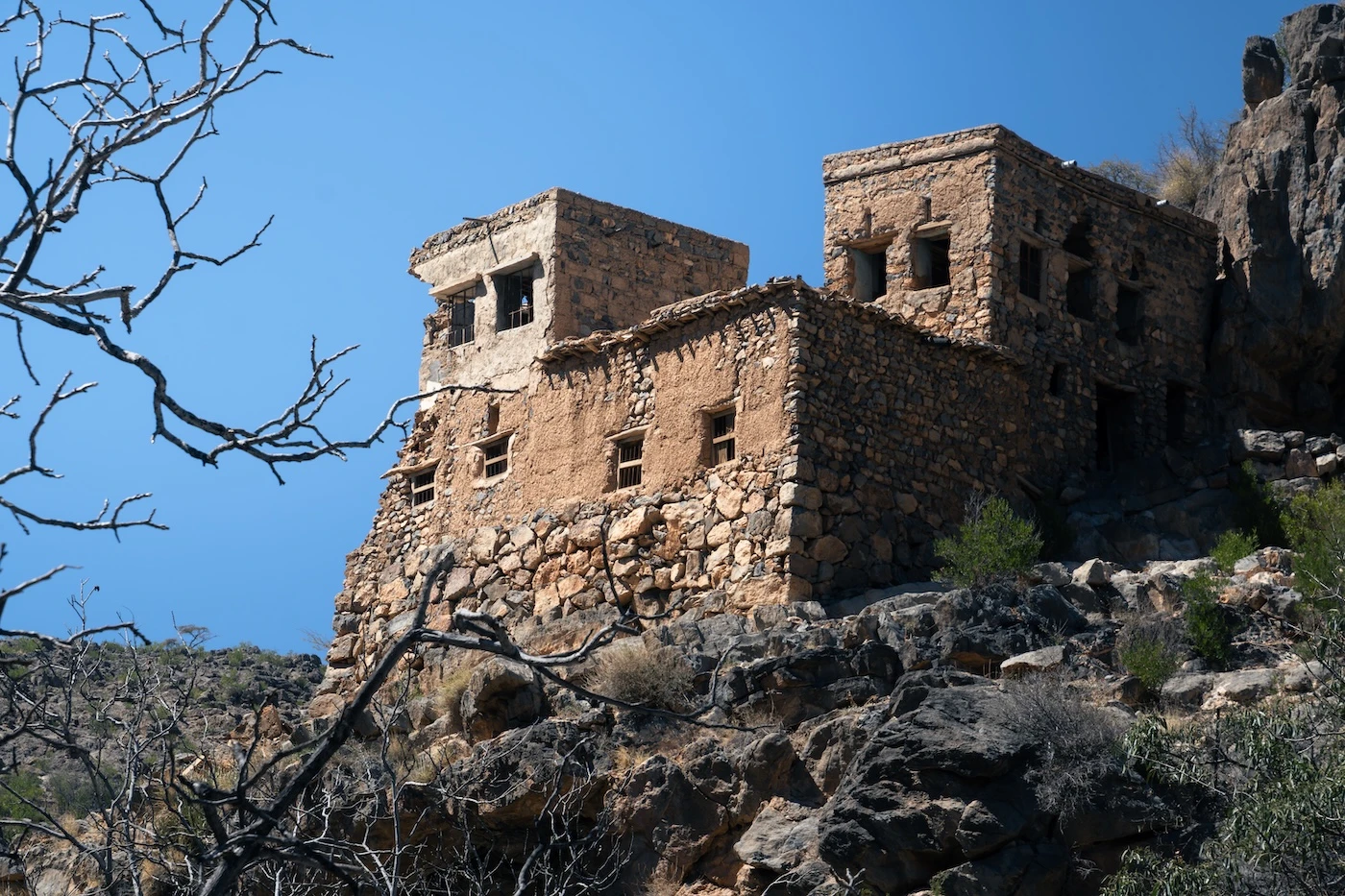
Traversing this abandoned village is a pretty easy hike, as Omani routes go (technically it’s two different village sections on separate parts of the wadi). It’s one of the more popular routes on the plateau.
The hike begins with some steepish but easily traversable stairs down to the valley floor and an orchard. From there, you can investigate either section of the wadi (it doesn’t really matter which way you go). The official route is kind of tricksy to follow, but it doesn’t really matter since you never really lose sight of the beginning (it’s impossible to get truly lost in the ruins).
Wadi Bani Habib is a good option if you’re short on time, because you can choose to visit as much or as little as you’d like, and the village is very close to the car park. It takes around 60-90 minutes if you don’t get lost, like I did. I actually ended up hiking the main W18 trail for a while by accident (I’m abysmal at navigation). It’s only around ten minutes to the first set of ruins so, if you’re in a rush, it’s easy to make a fleeting stop.
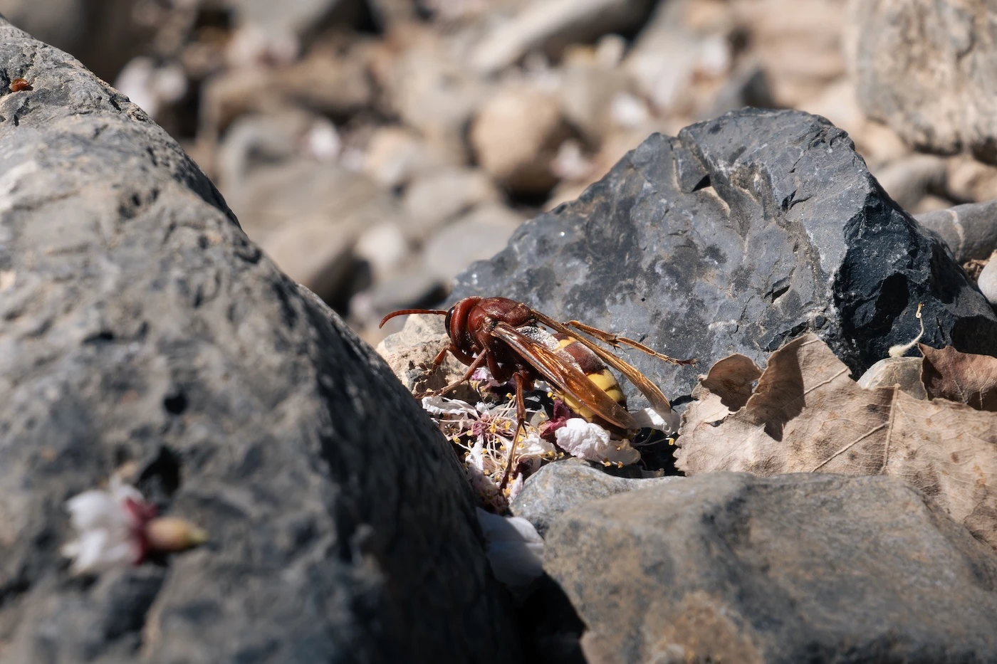
At the bottom, there’s a whole lot of fruit trees and pretty blossoms (but be careful of wasps!). Make sure you check out the incredible painted rooms, too. I’ve not seen anything like them elsewhere in Oman!
Distance from Anantara, Saiq: 20-minute drive
The Three Villages Hike
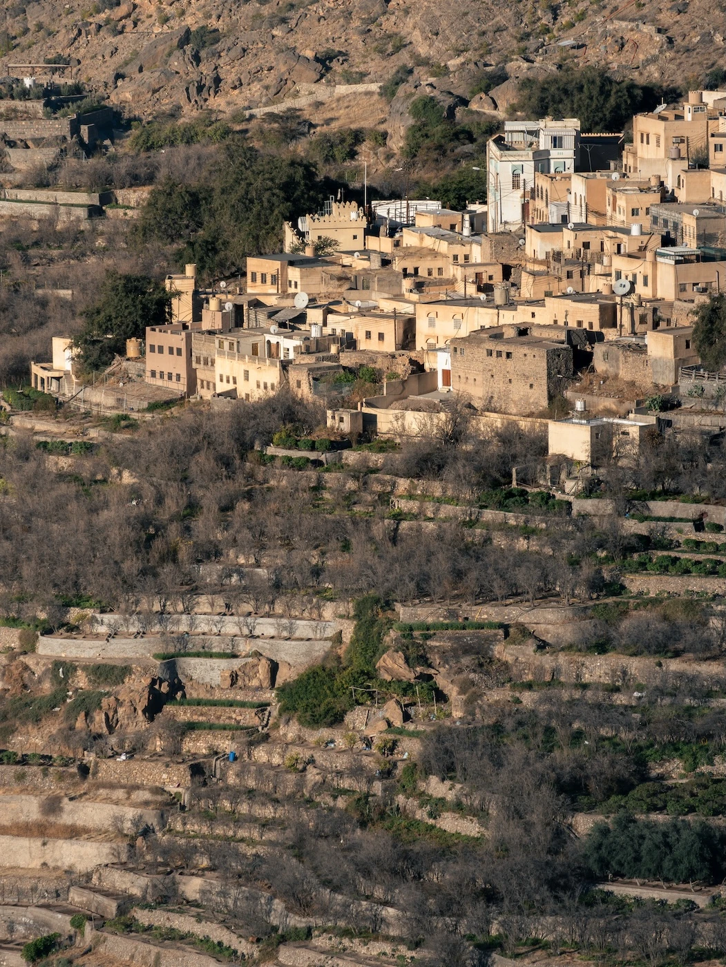
This is the most popular hike in the Jebel Akhdar region (which is no surprise since it traverses the prettiest villages along the edge of the main canyon). It’s one of the officially numbered routes, called W18b.
The trail passes through Al Akur, Al Ain, and Ash Sharayjah, the three villages of the title. These villages are iconic for their vast stepped orchard terraces (similar looking to rice paddies in places like Vietnam) that grow an abundance of fruit and damask roses during their various seasons. There are also the famous irrigation (or aflaj) structures to check out, too.
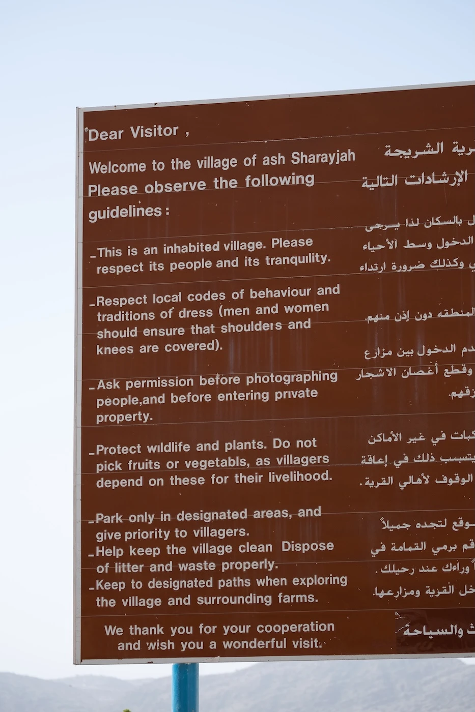
The hiking trail links each village, but you can also branch off and explore within them, too (follow all the rules on the signs at the village peripherals).
There are a number of cafes, hotels, homes and farms that you can stop and rest at, so this walk can take quite some time if you’re doing it at a leisurely pace and exploring! I’d schedule an absolute minimum of three hours.
The walk is reasonably easy overall but, if you do the whole thing, it is a moderate length and can be a bit rocky with a lot of steps. It’s an out-and-back hike, but you can kind of take quirky alternative sections and the views look are entirely different walking the opposite direction!
For the route, we’d recommend following the one on Wikiloc. We didn’t actually follow a route on our hike (you don’t need one) and didn’t get lost!
Distance from Anantara, Saiq: 0-minute drive

Other Hikes
There are so many hikes in the Jebel Akhdar region (the Omani people I’ve met love cross-fit, trail-running, mountain climbing ultramarathons, and anything insanely strenuous, so hikes are everywhere). Also, be aware that if an Omani tells you a hike is easy, it’s probably hard as nails.
Few of these hikes are named, signed, and marked with actual information, though. However, around the Alila hotel (30-minute drive from the Anantara, Saiq) there are a few designated hikes to go alongside the two I’ve written about above:
⬩ Mirage in the Mountains: this hike departs from the Alila and wanders along some undulating paths and wadis towards the abandoned ruins of As Sarab and a dam. It’s pretty easy but rough underfoot. If you have a 4WD car, you can drive most of the way and skip the actual hike by driving down a track to ‘The Jebel Akhdar Mirage‘. You’ll see the abandoned village right there, and it’s a few hundred metres to the dam.
It’s not the most exciting choice, in my opinion.
⬩ Lost Village Hike: I haven’t done this one yet, but definitely want to (I skipped it the last time I was in Jebel Akhdar because it was June and I was verging on heatstroke from just getting out of the car). It’s an out and back loop from Al Mihaybis, a little north of the Alila, and is described as ‘difficult’. It’s around eight kilometres but is pretty steep, with a elevation change of around 600 metres. It follows a trail deep into a narrow canyon with gardens, pools and villages to explore. It sounds immense and looks a lot like those off-corridor Grand Canyon trails, which I love.
Take a look on AllTrails.
⬩ Official numbered hikes: there are quite a few of these that pass through parts of Jebel Akhdar, including W15 through 25 (and more).
They are commonly long distance, strenuous routes; more than your typical day hike, and are ideal for backpacking trips (although, typically, you’ll end up a million miles from where you left your car, on the other side of a mountain range somewhere). However, it is possible to do only a small section of some.
Finding accurate maps of them is a tricky affair and many lesser hiked trails (or ones on Oman’s version of slick rock) do not show up on Google Satellite. I’ve mentioned it briefly below, but my favourite is W19, to the west of Jebel Akhdar.
Also, I’ve always wanted to hike the route W24 and W25 between the fruit-filled Wakan Village in the neighbouring Ghubrah Bowl and Al Manakhir Village in Jebel Akhdar. It looks like a magnificent challenge (and I love either end of it).
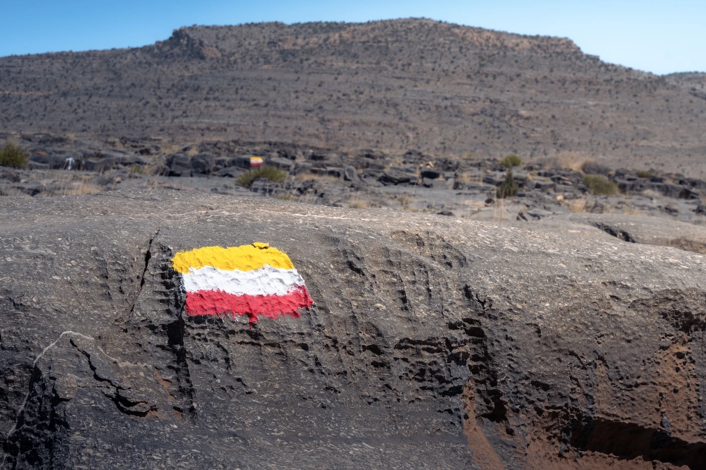
You’ll often see painted flags or green dots along the route as trail markers. You’ll see them everywhere (including at Wadi Bani Habib and the Three Villages Hike, too).

Venture Off Pavement
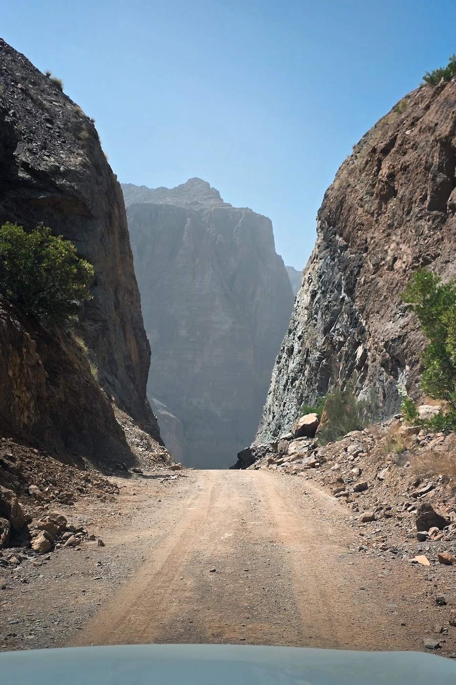
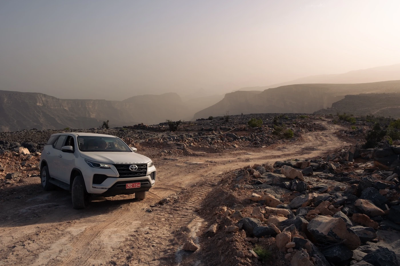
There are plenty of opportunities to explore off-pavement with your 4WD car. I’ll just mention my few favourite options:
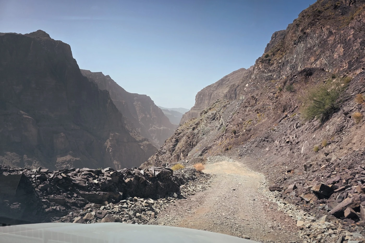
⬩ The easiest to access (and most obvious) is to drive down into the main canyon in Jebel Akhdar (the one with the three villages) towards Masairat A’Rawgeh. It’s a mildly rough route towards the end but is super scenic. The walk is only a few kilometres (that’s an estimate) so it’s short, really pretty and you can reach a few viewpoints that you cannot see from the canyon rim (including the tiny settlement at the end).
There’s a few other walks you can do in this area, too (you’ll be the only tourist there!).
⬩ My favourite offroad area in Jebel Akhdar is far to the west.
Head west towards Jaylil and take the left turn at 23.114370, 57.585853. Down here are roads with magnificent views, small villages, and opportunities for short hikes with literally nobody around.
Specifically, drive towards 23.100120, 57.527348. This cliff edge looks down into the farthest end of Wadi Qasha, leading to Wadi Tanuf (a cool canyon drive you can do from Nizwa and my personal favourite). Further down from there is part of the W19 hike around 23.098320, 57.513218 (look for the ruins of a village on a cliff to your right). Also, check out the nearby Wadi Qasha Viewpoint.
Anywhere around here is an immaculate choice for an isolated sunset.
The whole area is absolutely wild and a great place to wild camp if you’re looking for somewhere really isolated. It’s incredible in late afternoon light, but the roads get rougher and rougher as you go along so don’t stay after dark unless you’re planning on camping.
As Suwgra
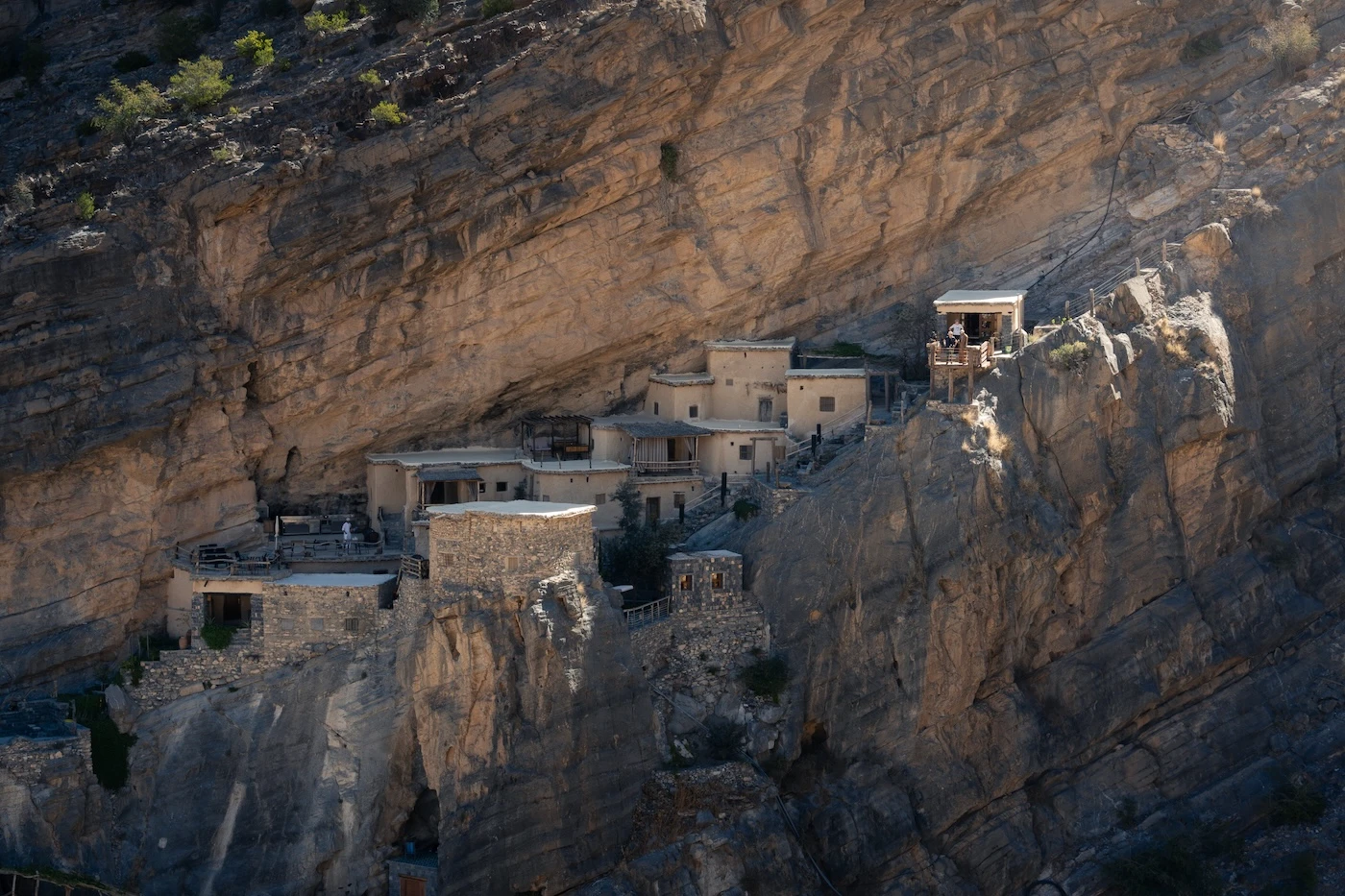
As Suwgra is a very cool, literally cliff-hugging settlement reached via a dirt track and then a brief hike across a deep wadi.
It’s one of those places that could have been abandoned but instead has been smartly adapted into a tourist attraction, with a beautiful heritage-style hotel and cafe that draw people in (beyond the obvious fascination with this intriguing location!).
We’d highly recommend a stay in the hotel, called The Suwgra – have a look at its almost perfect review scores – they’re outrageous. Be aware that there’s several hundred stairs and a ten-minute walk between the car park and the hotel (due to the nature of its cliffside location). The hotel will shuttle your luggage for you.
If you’re not able to stay overnight, tours of the village are available and there’s the really lovely Anat Cafe. it’s pretty unique place to drink a berry tea!
Distance from Anantara, Saiq: 30-minute drive
Viewpoints and Quick Stops
Below is a (non-exhaustive) list of spots where you can get some great views without having to hike! Many of them don’t really have specific names, especially the more remote locations, so I’ve given GPS points and put them on the downloadable Google Map further down.
In and Around the Main Canyon
⬩ Diana’s Viewpoint: this one is not my vibe, mostly because it’s been commandeered by the Anantara and, unless you’re a paying guest, I’ve read it can be awkward to access. Obviously, if you’re staying there (which I’d recommend) then it’s perfect! There’s an alternative, free spot just outside the hotel on the northern side, next to the Layali Al Jabal Restaurant if you’re not, though. Check out one of the roadside cafes, nearby, too: my favourite is Lmad Cafe Truck.
⬩ Just below the Anantara, there’s a road that runs down to the Terraced Fields Viewpoint, which is a nice alternative. It’s not the best view, though, and parking can get busy down there with people visiting Al Akur, especially in March and April.
⬩ I prefer the solitude of the scenic viewpoint reached by following the steep road around the eastern side of the newish Hotel Indigo. Further down, there’s a dirt track that splits left from the paved road leading to Al Qasha, around 23.064510, 57.666260. Here is a beautiful little spot that overlooks the small settlements and wiggly roads in the canyon.
⬩ Further down the road is a nice spot, too: 23.056962, 57.659650 (unpaved).
⬩ Near the Prince of Qatar’s Castle: there’s a nice alternative view towards Ash Shurayjah at 23.060574, 57.649248.
⬩ Sunset view point: an easy, free spot in Saiq, directly above Al Ain and Al Aqur, with good views of the terraces. You can see residents hiking up and down from the villages on the trail there and I find that it provides a little perspective.

Away from the Main Canyon
⬩ As Suwgra: as mentioned above, this village is a photogenic and improbable sight (unpaved).
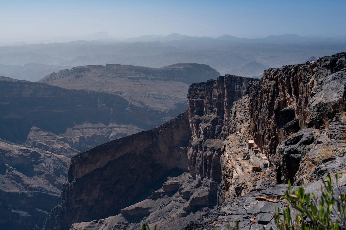
⬩ 23.100130, 57.527469: insane vistas across Wadi Qasha into Wadi Tanuf. One of my favourite spots in the entire of Oman (I love me some barren, dramatic terrain) (unpaved).
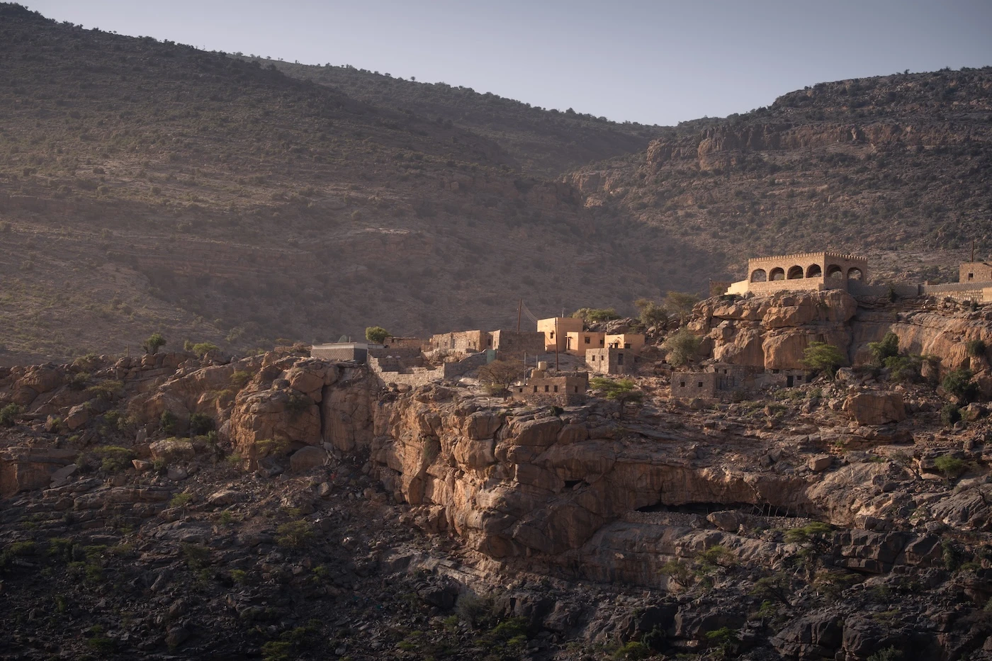
⬩ Ar Ruus: this tiny precipitous village overlooks a magnificent valley nearby the Alila. The views are magnificent, especially later in the afternoon.
⬩ 23.160308, 57.619474: for a remote viewpoint over Wadi Bani Kharus and an ideal campsite. It’s around a 30-minute drive from the Saiq town (unpaved).

How Long to Spend at Jebel Akhdar
We think Jebel Akhdar deserves at least an overnight trip to see the main spots and a two-night stay is ideal if you’re a hiker, photographer, or want to explore extensively off road.
There’s lots to do and it takes a while to get up there so it’s nice not to rush around. It’s also worth staying overnight purely to watch the sunset along one of the canyon rims.
However, if you only have time for a day trip from Muscat, that is still a viable option with some solid planning.
In One Day/Night: An Itinerary
Drive up from Muscat or Nizwa, arriving in Jebel Akhdar mid-morning. I would recommend a quick trip to a Lulu Hypermarket on the way for some fresh food so you can eat lunch whenever and wherever you want (the grocery options are not overly inspiring up on the plateau, aside from all the fresh in-season fruit).
Explore Wadi Bani Habib as a first stop. You can also just spot the buildings from near the top which will take a lot less time if you can’t walk the entire route. Grab some fresh pomegranate from the fruit stands if it’s in season.
On your way back from Wadi Bani Habib, consider checking out the ludicrously positioned ‘Prince of Qatar Castle‘ and head just past the paved road section; there is a lovely alternative view of Al Shuraijah Village and the canyon below.
If you’re curious, you’ll also drive past a small crash site that’s home to the partial wreckage of a British fighter plane from 1958 – there’s no signage or information, so it’s only worth stopping for if it’s something you’re interested in.

In the early/mid-afternoon, head to the Three Villages Hike car park (W18a). The route is totally doable in three-four hours if you don’t dawdle, but it’ll depend on how many stops you make and how fast you walk.
Choose a nearby spot for sunset. Either go for ‘Sunset view point‘ or the Princess Diana Viewpoint (but the free one, to the side of the Anantara). I prefer the former. I also love this scenic point in the canyon at sunset, too, although it can be kind of dark. Be aware: the road is really steep.
The next morning, explore the rough 4WD route down to Masairat A’Rawgeh from the canyon rim. It’s spectacular.
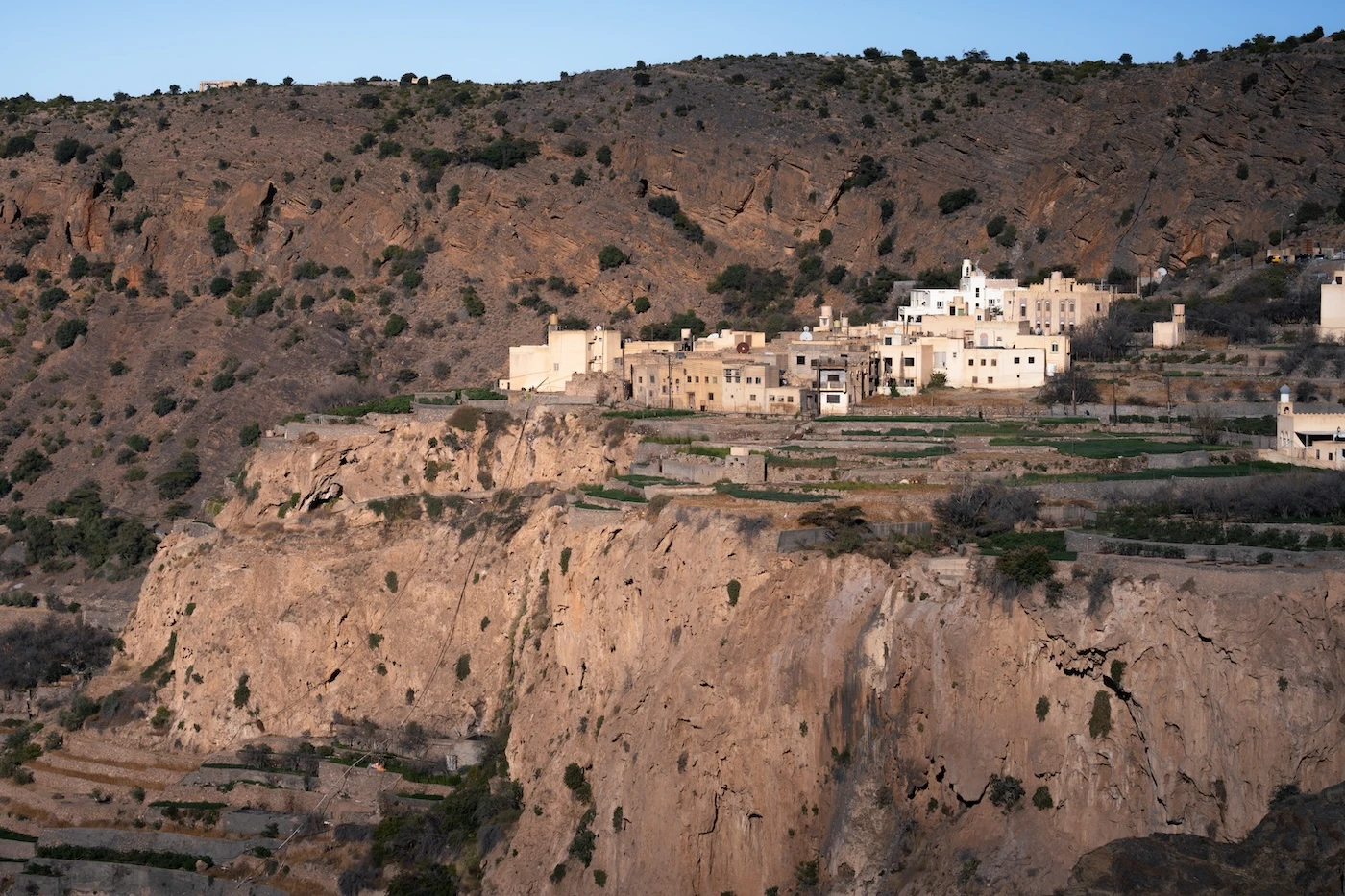
In Two Days
One your second day, it’s worth exploring further afield. These are a few of your options:
⬩ First thing, head up past the Alila hotel and take on one of the hiking opportunities there, like the Lost Villages hike, then a few viewpoints around Ar Ruus. This particular hike would take a big chunk of your day.
⬩ After that hike, go for some unpaved adventures in your 4WD to rest your legs. Head out west towards Jaylil and take the left turn to explore the remote roads, views and villages in the area. I’d stay here until sunset.
⬩ With any spare time, I’d highly recommend taking the short drive down into Jebel Akhdar’s main canyon past where the three villages are located. Head towards the tiny semi-ruined village of Masairat A’Rawgeh via some absolute corkers of unpaved tracks and mountain peaks.
⬩ For a remote lunchy-picnic spot, route to 23.160308, 57.619474 for insane views over Wadi Bani Kharus. It’s also a fantastic place to wild camp, so if this interests you, head up here at sunset instead.
⬩ If you’re visiting around April, it’s worth checking out the damask roses and how they’re processed into rosewater at Bait Asarh Cafe and Rosewater Factory (or any of the small businesses on the Three Villages Hike). If you’re there in September, visit the nearby Pomegranate farm instead!


Where to Stay
There are a few different styles of accommodation if you’re staying up on Jebel Akhdar. Alternatively, you can stay in Nizwa.
We’ve stayed in quite a few hotels in Nizwa, several in Jebel Akhdar, as well as camped in the area. For our Nizwa recommendations, including budget, heritage and modern hotels, take a look at our post dedicated to the city.
Below are our current recommendations for Jebel Akhdar (with some we can’t afford):
As Suwgra: an incredible cliff-side heritage hotel with luxury fittings that you wouldn’t expect hanging off a mountain wall! Absolutely outstanding, with nearly perfect review scores, too.
Hanging Terraces: another beautiful heritage hotel, this time located in the first of the three villages on the eponymous hike, with the best (in my opinion) views of the terraces and canyon you can get.
Alila: the most expensive hotel in Jebel Akhdar. If you’re looking for the ultimate in luxury and solace, this is the top choice. I prefer this one to the Anantara, below, just for its design and character. If you can part with the money, choose this hotel!
Anantara: the other expensive hotel in Jebel Akhdar. It’s beautifully designed, as you’d expect from an Anantara). Situated right on the edge of Saiq, so you can walk to the town, it also overlooks the main canyon. Choose this one if you want to be in the centre of things (and choose the Alila if you prefer to be a little more out of the way).
Hotel Indigo: the newest rim-side hotel, sat right next to the Anantara. It’s a little more affordable than the Anantara, with similar facilities and views (still pricey though!). When we were last there in June 2026, it was open but there were still building works going on.
Dusit D2: away from the rim but perfect for families, with a lovely pool, great central location and smashing breakfast. We stayed at this one recently and got a really, really good deal on the super modern rooms and food. I think it offers the best balance of modern rooms for price on the plateau.
Green View: a family-owned, simple, modern, and right in the middle of Saiq next to loads of restaurants. We stayed there during its soft launch phase and it’s a great mid-budget choice.
Sama Hotel: a big, reasonably priced hotel right on the rim with a classic Omani vibe, located near the Anantara in the main canyon.

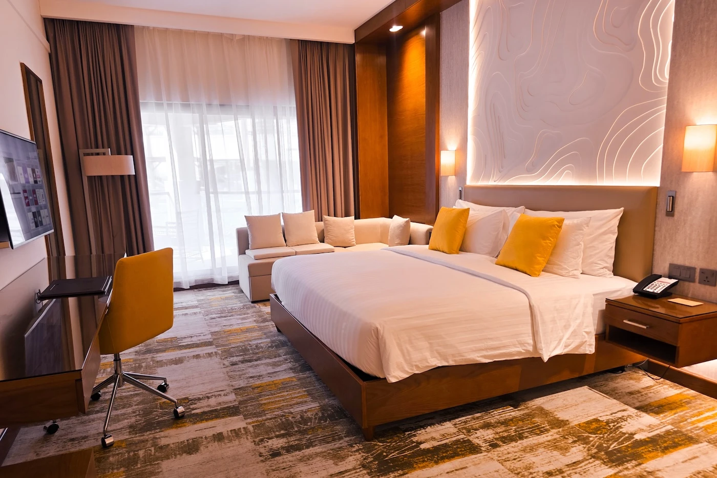
Camping on Jebel Akhtar
Accommodation is kind of expensive up on Jebel Akhdar. I think the costs are worth it for a once-in-a-lifetime experience, but wild camping is a fantastic free option if you’re amenable to it and on a budget. Below are areas we’ve camped or have found that would be amazing for camping:
⬩ Wadi Bani Kharus overlook: this is the best place to camp in in Jebel Akhdar, in my opinion. The entire track, from 23.122146, 57.612905 to its terminus, offers a huge variety of flat, isolated places to camp. There are too many decent places to list here.
⬩ Alternative camping area: on the other side of the road from the above, there are decent enough campsites right near the road, but nobody can see you. Head for 23.118162, 57.603528.
⬩ Camping Area Al-Jabal Al-Akhdhar | موقع تخييم الجبل الأخضر: this is a rare spot with facilities! It has bathrooms, picnic shelters and actual parking. That’s a rarity.
⬩ Easy camping near the Alila: head to 23.146731, 57.538387 for a banging little area with canyon views and perfect sunsets (and it’s right next to the most expensive hotel in Jebel Akhdar!).
There are loads of other places to camp in the region – just look for anywhere that’s away from residential areas and villages. It’s also possible to camp down at lower elevations during winter, in the adjacent mountains and foothills.

What Should YOU Wear?
Jebel Akhdar is a rural region and, as such, is quite conservative compared with Muscat.
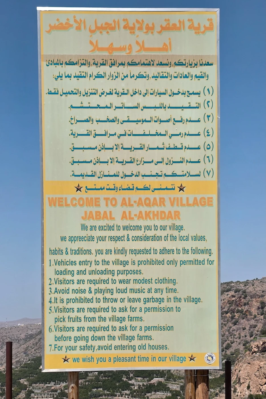
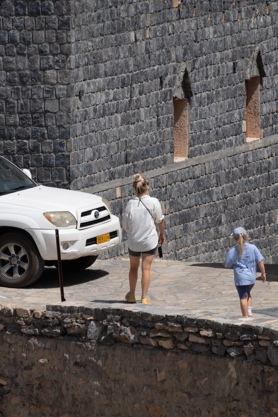
This means you should dress modestly, with local culture and residents in mind, ensuring you stay covered at least from the elbows to the knees (for both men and women). Ideally, men should not wear shorts.
Women are not required to cover their head anywhere in Jebel Akhdar unless visiting the mosque.
There are signs everywhere prohibiting shorts and skimpy clothing, but we always see some obnoxious visitor ambling around like it’s fine (most recently it was a blond woman in short shorts). I don’t know if they just missed the signs, couldn’t read them or just didn’t care enough to change, but you just don’t want to be that person.
In Oman, I wear a long dark skirt and dark t-shirt with a wafer-thin, surprisingly cooling, black motorbike UV hoody from Bangkok. I fit right in and have a dark hood in case I want to cover my hair.
–
Facilities on Jebel Akhdar
The main town on the plateau is reasonably large and has all the facilities you need to get by for a day or two.
There’s one petrol station (which doesn’t charge a location premium), lots of restaurants (not the most veggie friendly options, mind), simple grocery shops, road-side stalls, pretty cafes and several ATMs.
Most businesses take card, but in the tiny villages ensure you have some cash if you want to buy something.
There are no large supermarkets so if you need something specialist, buy what you need in Muscat or Nizwa.
GOT EVEN MORE TIME IN OMAN?
Go camping:
Sleep under the stars at these amazing wild camping locations
Plan your trip with our Oman camping guide
Camp atop Oman’s highest mountain
or camp in the palest of Oman’s deserts at the Sugar Dunes
or have a totally unique adventure:
Spot the most remote beehive tombs in Oman
Wander around Oman’s most photogenic fort
Learn about livestock at the Nizwa goat market
Take a look around Oman’s most unique fortification
–
Google Map of Jebel Akhdar
Below is a Google Map with markers for everything mentioned throughout this post.
⬩ Yellow: places to visit around Jebel Akhdar
⬩ Green: hotel options
⬩ Purple: campsites
⬩ Blue: viewpoints
⬩ Orange: towns, cities and villages
To save this map, select the star next to the title.
HAVE WE HELPED YOU PLAN YOUR Oman TRIP?
If you’ve found our content helpful, consider booking your rental car (if you need one!), through the company we always use – Discover Cars. They’re the absolute best and have been our rental companion (and saviour, thanks to their insurance) in many destinations across the world.
Also, consider securing you accommodation through Booking.com – we use them exclusively when travelling in West Asia.
Alternatively, leave us a tip to say thank you.
Help like this makes it easier to pay for the upkeep of this site and ensures our small business survives the onslaught of AI!
Thanks for reading.
–
Where to Next?
Jebel Akhdar is a popular place for visitors in Oman, but few people really travel beyond the surface. I hope this guide has provided you with loads of options to make your trip as interesting a possible!
The ‘Green Mountain’ is just one small segment of the wider Hajar range and is no more spectacular than the rest of the region so, if you get the opportunity, give some other parts of the mountains some love, too.
We’ve written a detailed itinerary route for offroading through the mountains which covers all the best areas, plus camping opportunities, so if that’s something you’d be interested in, take a look.
Alternatively, if you’re spending time in Muscat, check out our detailed two-day itinerary – it’s got everything you need to know.
Have a great trip!
Hi, thanks for visiting our blog! If our free content has been of help to you, or you’ve just enjoyed our random ramblings and musings, say thank you by buying us a coffee! It helps keep The Restless Beans blog up and running.
Thank you, Claire + Nick


